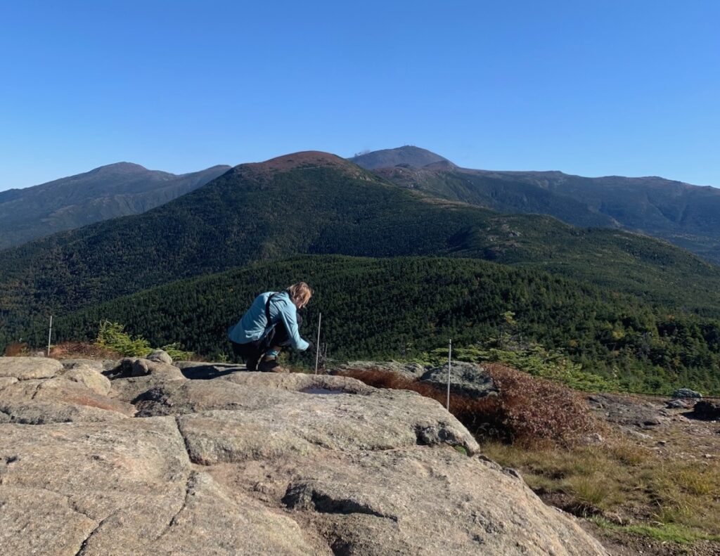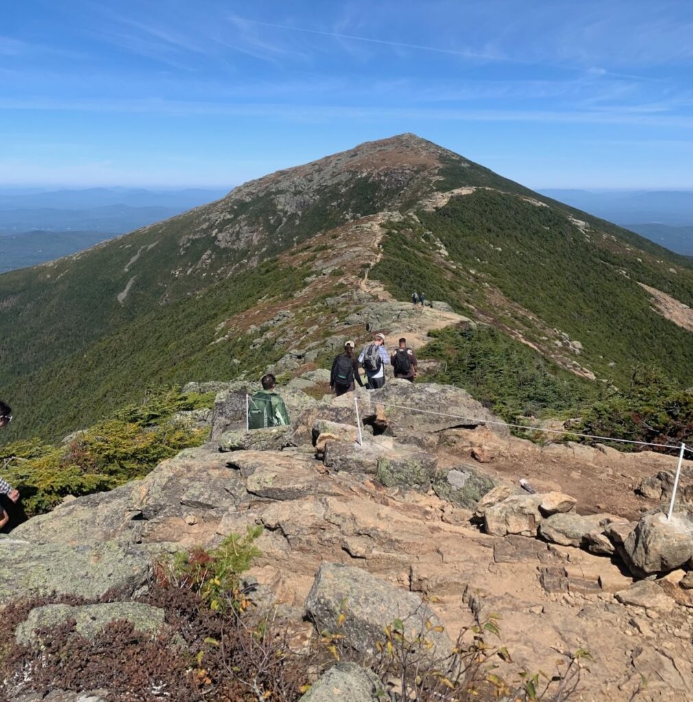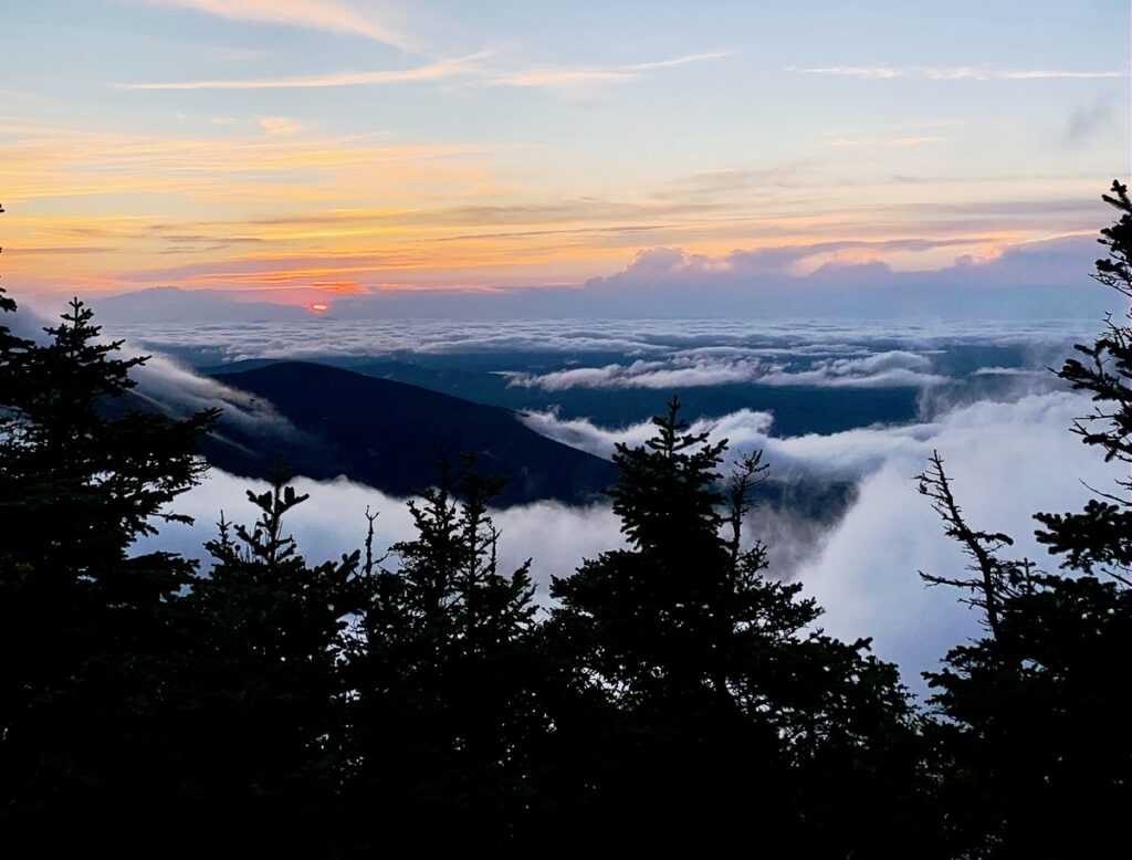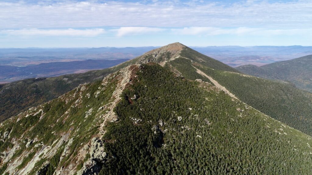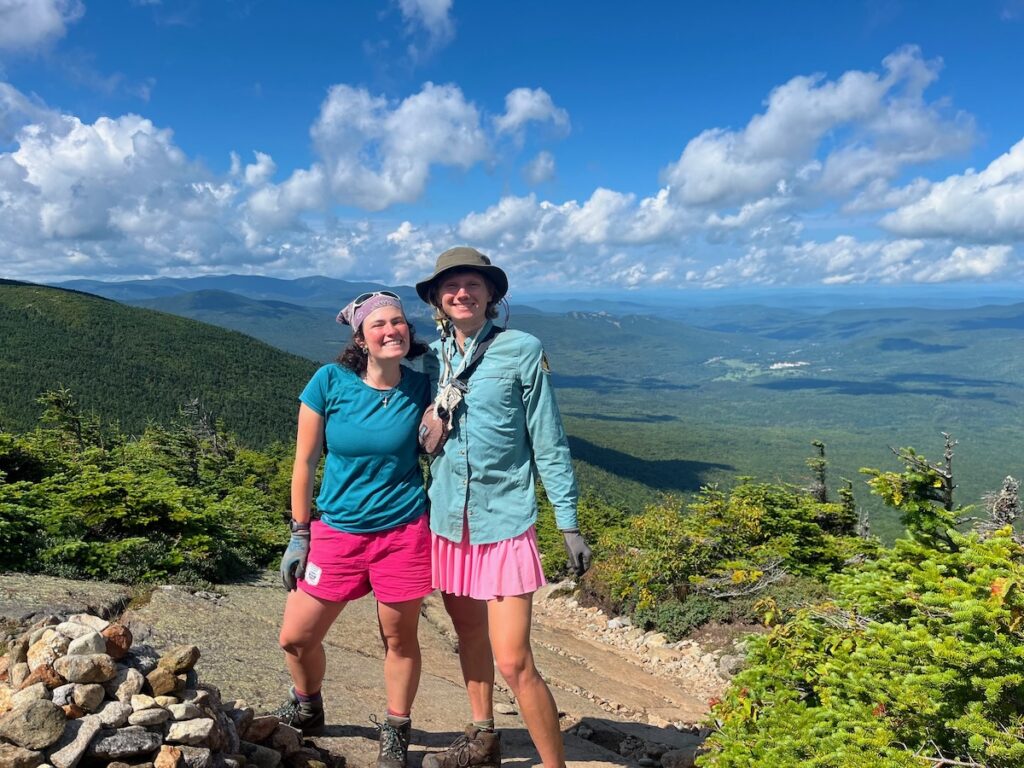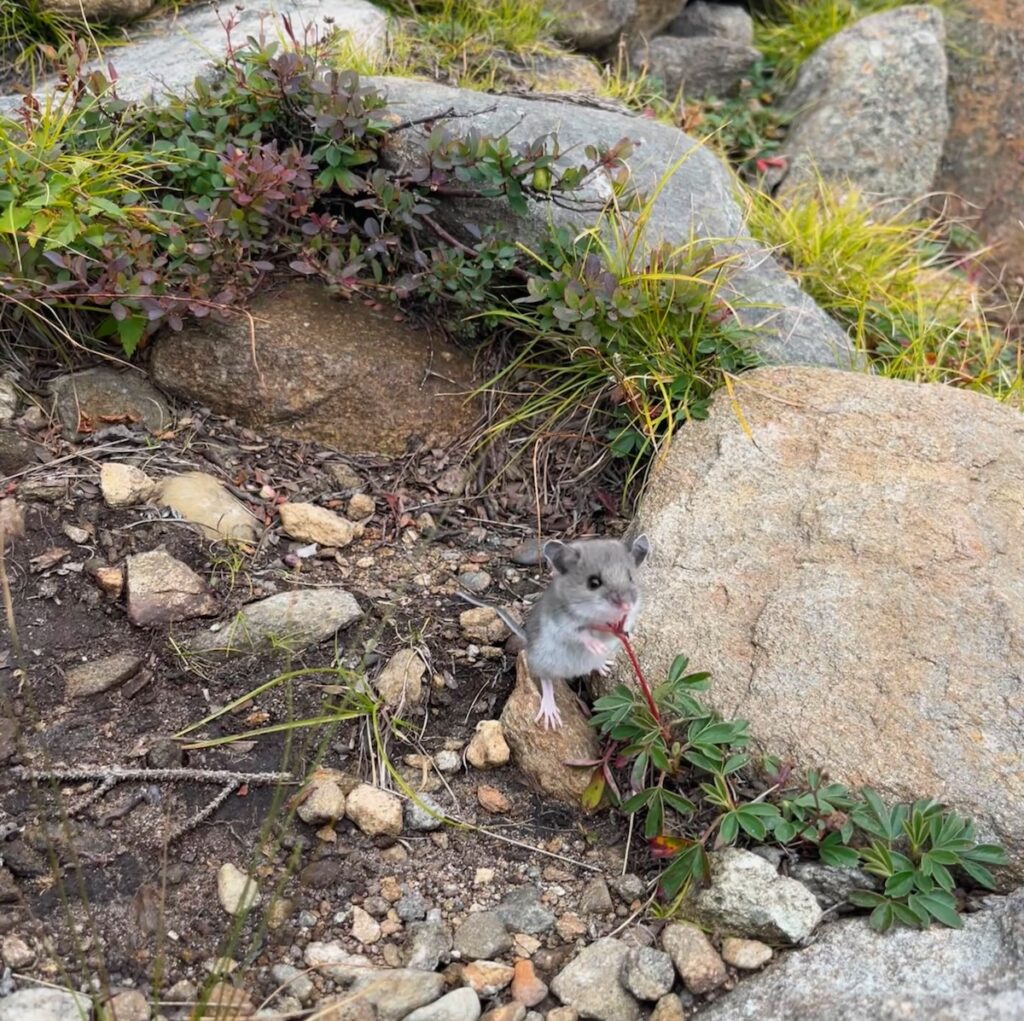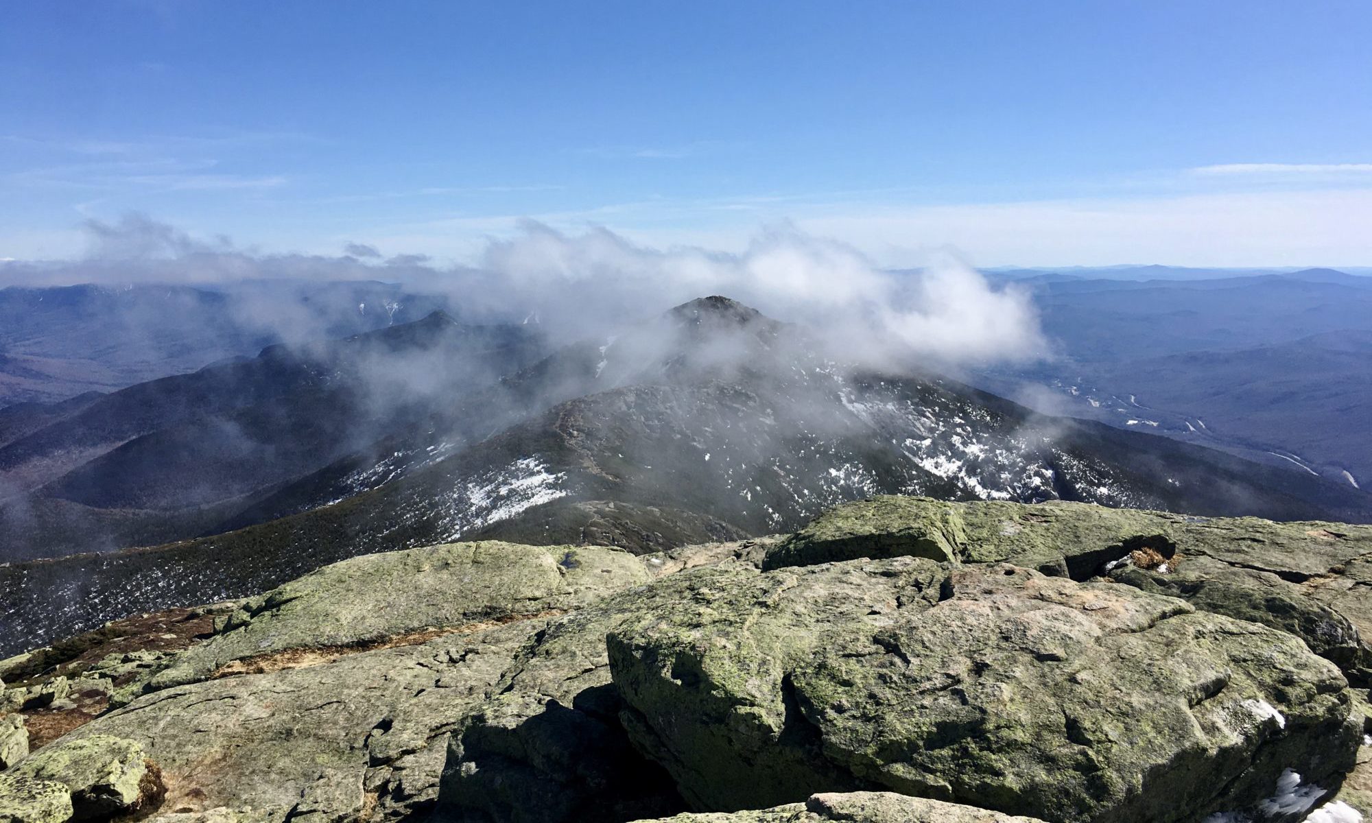
This weekend Summit Steward Demi Terry had the weekend off, so I traversed the ridge solo and was in for an unexpected weekend.
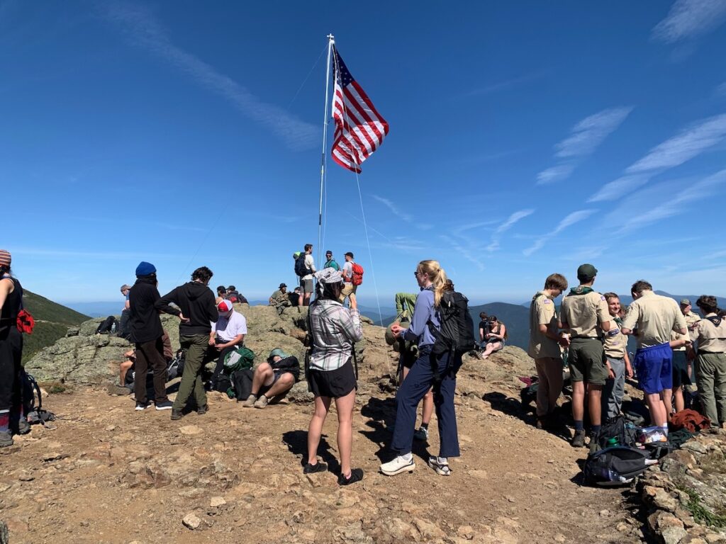
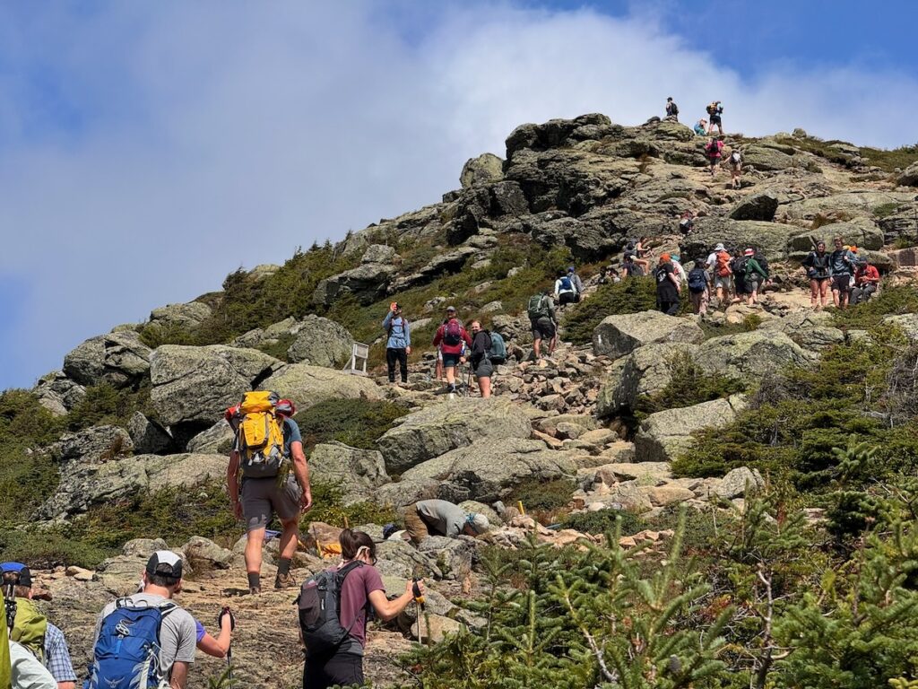
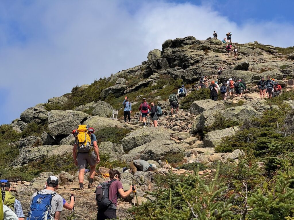
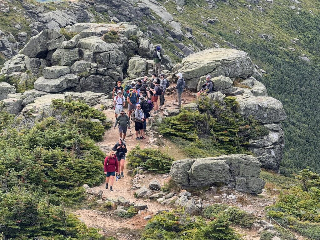
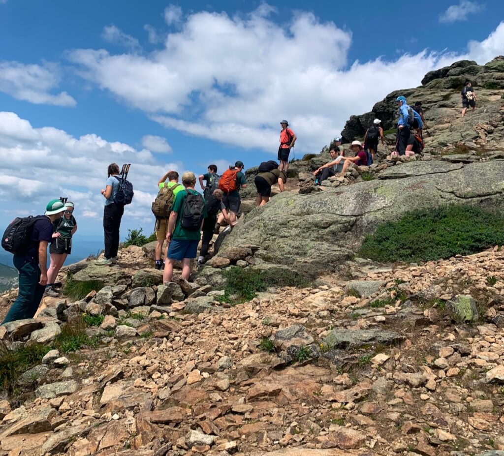
On Saturday, September 12th, we were predicting a less populated ridge following the holiday weekend the previous week, but this was not the case. Due to the annual Flags on the 48 event, the ridge was insanely busy, with most people congregating on the summits of Mount Lincoln and Mount Lafayette.
In the morning, I focused on finishing the string fencing project I have been working on for the past few weeks on the north and south sides of Mount Lincoln. This week, I focused on completing the fencing ascending Mount Lincoln from the south, but ran out of string around lunchtime. My plan was to continue the work the following day.
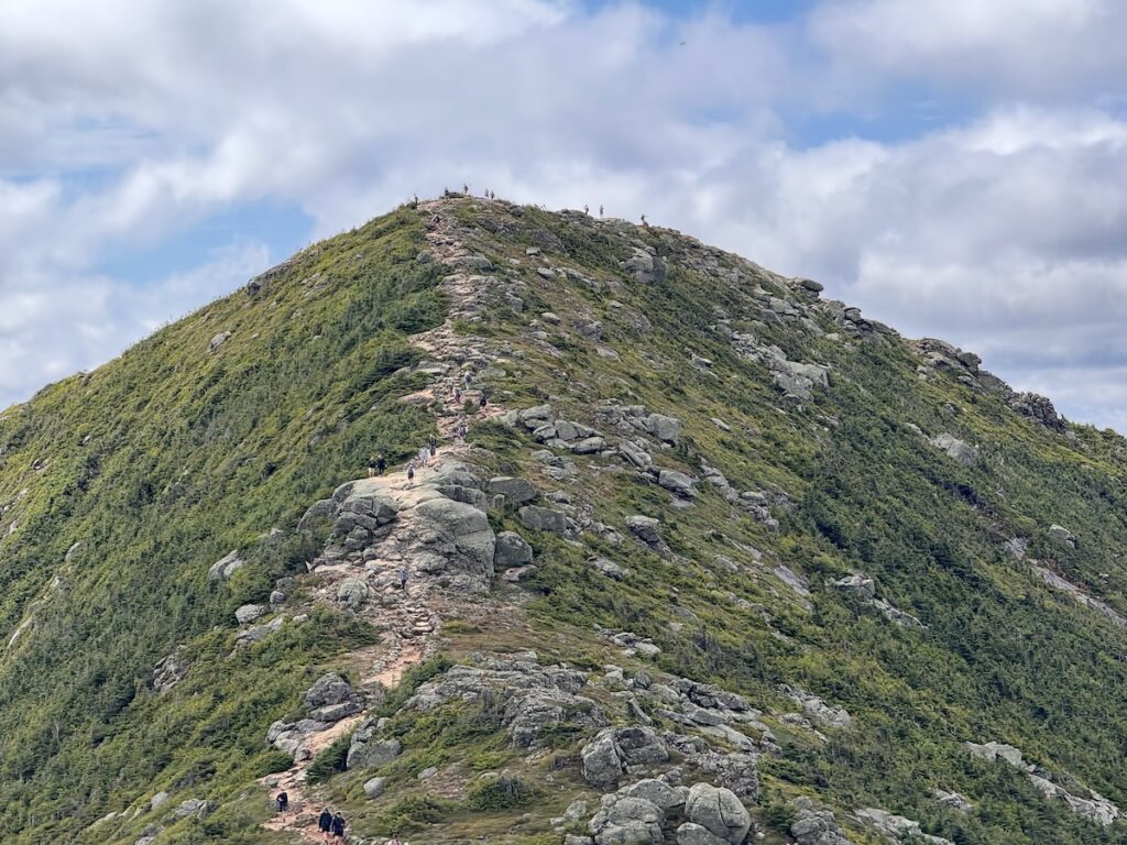
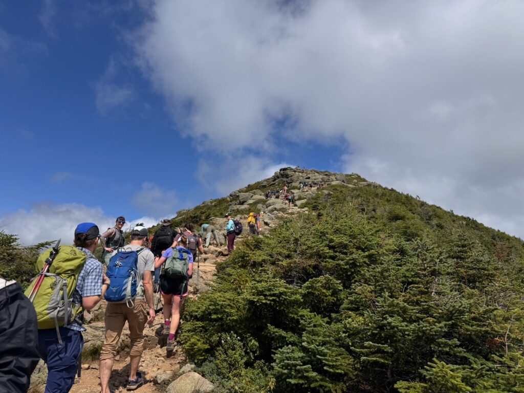
When I ran out of string, I headed to the summit of Mount Lincoln to eat lunch and planned on stewarding there for the rest of the day. I was met with a large and ever-growing crowd of people. I sat at the summit from 12:30–3:30 p.m. and was never greeted with fewer than 50 people. The event brought crowds of people and also restricted the available space on the summit because of the flag installation.
Every few minutes, I was asking people to step back to the correct side of the scree wall, remain on the trail, and respect the alpine vegetation, while also explaining my position and the importance of protecting the alpine zone. Although the numbers for this Saturday were relatively average for this summer season (1,265), this was an extremely overwhelming day because of the concentration of people on the summits.
After my time at Mount Lincoln, I ventured over to Mount Lafayette to meet up with AMC Volunteer Alpine Steward Lindsey Bost. Lindsey, too, was overwhelmed by the crowds gathered for the event. She had a particularly intense encounter with an extremely intoxicated hiker at the summit of Lafayette, who interrupted her during a summit talk and caused a large scene. After discussing the situation with him privately, she could smell alcohol on him and hear empty cans clanging in his backpack. This kind of behavior is not only disheartening to see on Franconia Ridge, but extremely dangerous given the nature of the trail and the descent down the Old Bridle Path that this man was evidently going to have to endure.
In addition to the difficult crowds and intoxicated hiker, we also had a hiker suffer a sprained ankle on the Upper Greenleaf Trail, resulting in a Lakes Region Search and Rescue team litter carry-out. Unfortunately, both Lindsey and I were still stewarding the summits when this occurred, but I heard from other hikers that the injured hiker was able to self-rescue as far as Greenleaf Hut, where the SAR team met her.
An additional search and rescue was performed by the Greenleaf Hut Croo that same night after a hiker mistakenly wandered down a water bar while descending the Upper Greenleaf Trail. This hiker was unfortunately unprepared and unfamiliar with the backcountry and needed assistance from the Hut Croo. Thankfully, he was only around 50 feet away from the main trail, and the Hut Croo was able to locate him simply by calling his name.
Overall, Saturday brought intense and overwhelming crowds. Every weekend we see more and more people traversing the ridge who are unprepared and unfamiliar with the nature of the backcountry and the environment they are traversing.
Sunday, September 13th, and Monday, September 14th, brought a mix of cold temperatures, high winds, and rain. This put me in a position where I wasn’t comfortable traversing above treeline by myself. Instead, I remained around the hut as a resource for hikers. I turned multiple groups away on Sunday who were unprepared for the conditions. On Monday, I focused on pruning and removing branches along the Upper Greenleaf Trail that were infringing on the path.
This is the third in a four-part series reflecting on the accomplishments of the Franconia Ridge Loop Restoration, what we could have done better, and where we go from here.
In the previous article, I discussed some of the things we got right in the Franconia Ridge Loop Restoration: trail realignment, reverse-grade drainage, carefully designed step clusters, foundation steps, full-bench construction, proper tread preparation, and trail widths appropriate for very high levels of use.
Together, these represented an important advance toward a new standard for sustainable trail construction in the White Mountains.
But we did not apply that standard consistently. Understanding why is important, not to diminish what has been accomplished, but because the lessons from this project should inform how we plan the next generation of major trail projects.
An Ambitious Goal Without a Complete Plan
We should begin by acknowledging that the original goal of the project, to “redesign the Franconia Ridge Loop from start to finish,” proved overly ambitious given the available funding and the actual condition and use level of the trail.
As mentioned in the first article, five years later, substantial work remains even on the two major approach trails, Old Bridle Path and Falling Waters Trail. Only a relatively small amount of work has been completed on the upper Greenleaf Trail in the alpine zone. And no congressionally funded restoration work was undertaken on perhaps the most ecologically sensitive portion of the entire Loop: the Franconia Ridge Trail between Mount Lafayette and Little Haystack.
Part of the problem was built into the project from the beginning.
The approximately $1.125 million in Congressionally Directed Funding was not the result of a detailed assessment of every section of the Loop followed by engineering and trail-design estimates of what it would cost to rebuild it. Rather, it represented the level of funding that could be secured through the congressional appropriations process.
That is understandable. Nothing comparable had previously been attempted on this scale in the White Mountains, and more than a million dollars sounded like an enormous investment in a single trail system.
And it was an enormous investment.
It just wasn’t enough to accomplish the stated goal.
The Missing Variable: Use
One reason the cost was underestimated was that we had not fully incorporated the extraordinary volume of use on the Franconia Ridge Loop into our understanding of what reconstruction would require.
Today the Loop receives approximately 45,000–50,000 visitors between May and October. That changes almost everything about trail design.
A technique that might perform adequately on a trail receiving a few thousand hikers annually can deteriorate rapidly when thousands of boots pass over it in a matter of weeks. A narrow tread that works perfectly well elsewhere can result in hikers continually stepping around one another. Organic soil that might gradually compact and harden on a lightly traveled trail can quickly turn into mud, exposed roots and displaced tread material. A drainage feature requiring regular cleaning becomes a significant liability if the maintenance system cannot reliably provide that cleaning.
Add increasingly intense rain events, and the engineering challenge becomes greater still.
This had a cascading effect on the project. As it became apparent that the available money would not rebuild the entire Loop to the standards we had envisioned, choices had to be made about how far the money could stretch.
There was another structural problem as well. The congressional funding applied to the portions of the Loop on federal land, leaving significant sections of the Old Bridle Path and Falling Waters Trail within Franconia Notch State Parkoutside the federally funded project.
WTN Americas was ultimately able to secure private funding, later supplemented by a New Hampshire Recreational Trails Program grant, to begin filling that gap. But ideally the Loop would have been conceived, assessed, designed and funded from the beginning as one trail system crossing two jurisdictions.
We Established Standards, Then Lost the Mechanism for Maintaining Them
There was an important effort at the beginning of the project to address precisely these questions.
The Partnership to Restore the Franconia Ridge Loop formed a trail standards working group during the first year. That group brought people together to establish many of the design and construction principles discussed in the previous article.
That was exactly the right idea.
Unfortunately, the working group stopped meeting.
Without a continuing mechanism for reviewing design, comparing work among different crews, documenting what was being learned, and adjusting standards as the project progressed, some of those standards were applied inconsistently.
Four examples stand out.
Trail Width
One was tread width.
Early in the project, we recognized that a trail carrying tens of thousands of hikers must be wide enough to accommodate actual visitor behavior, including people passing one another without continually stepping off the constructed surface.
As costs increased, however, reducing tread width offered an obvious way to make limited funding cover more trail.
In some places, I believe this went too far.
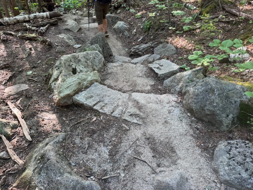
There are reconstructed sections where the tread is narrow enough that hikers meeting one another are likely to step outside it. At Franconia Ridge levels of use, thousands of seemingly insignificant passing movements can eventually widen the trail anyway, except that the widening occurs through trampling and erosion rather than intentional construction.
This illustrates one of the central lessons of the project:
Reducing the dimensions of a trail does not necessarily reduce its ecological footprint.
Sometimes spending more to construct a wider, durable tread is precisely what allows us to keep people within a smaller overall corridor.
Foundation Steps
Foundation steps were another standard applied inconsistently.
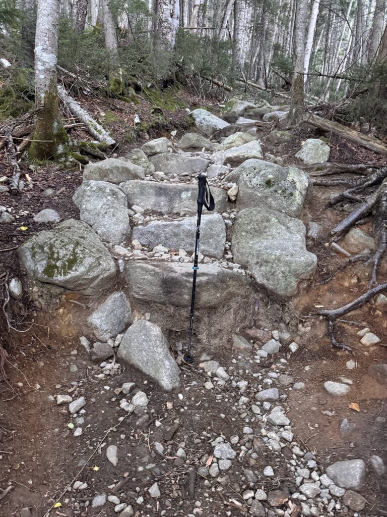
As discussed in the previous article, a properly placed foundation stone at the base of a stair cluster protects the staircase from being undermined as water and foot traffic remove soil below it.
For some crews, this represented a different approach from their previous stonework practices. It also requires another substantial piece of stone and additional labor. Under the pressure of time and budgets, that additional work can seem expendable.
It isn’t.
Where a staircase is undermined from below, the effective height of the bottom step increases and the stability of the staircase above can eventually be compromised.
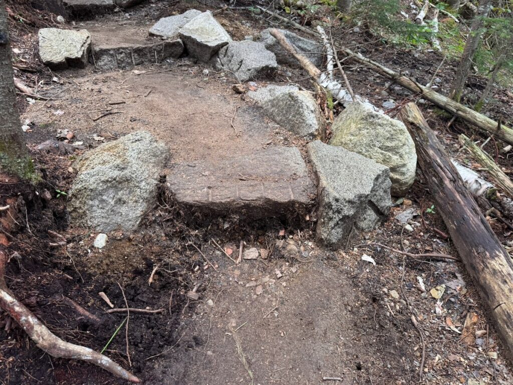
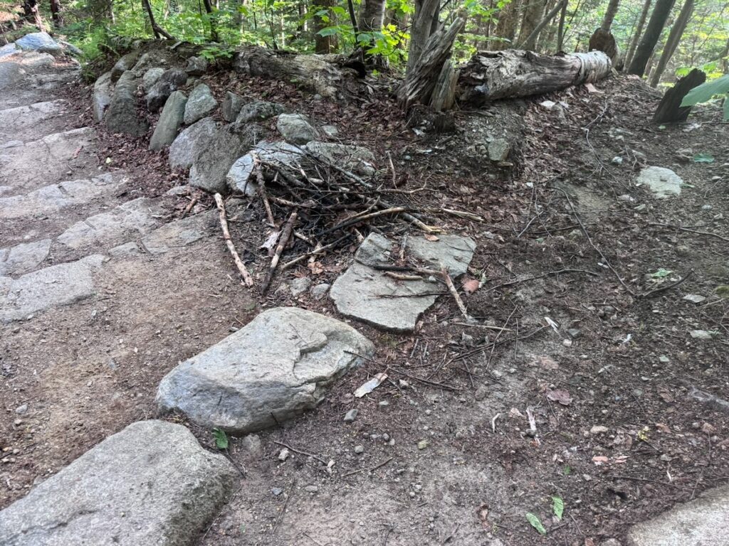
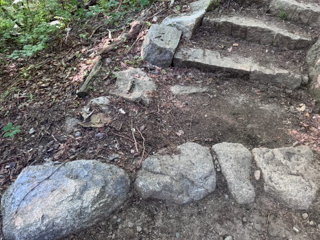
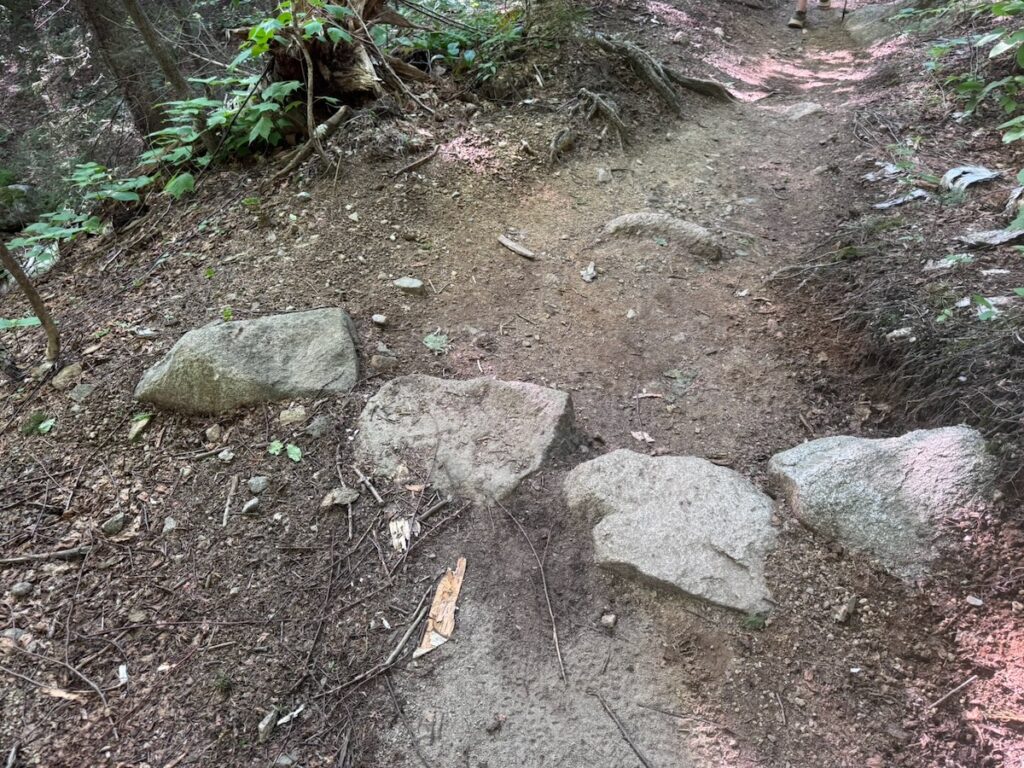
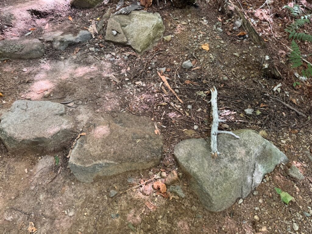
We are also discovering something we did not fully anticipate. In some locations, foundation stones that were originally flush with the tread, or even slightly buried, are now protruding two to four inches after only a few years as surrounding tread material erodes.
If that continues, a foundation stone intended to protect a staircase can eventually become a step itself, but a step with no foundation stone beneath it.
That tells us something important. Even some of our improved construction techniques need to be monitored over time and modified in response to what actually happens on a trail receiving this intensity of use.
Waterbars Versus Drainage Built Into the Trail
We also did not consistently make the transition from traditional waterbars to drainage created through trail alignment and grade reversals.
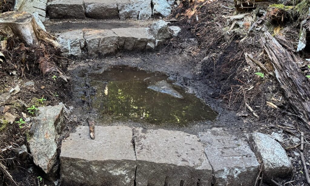
Some newly reconstructed sections still rely on waterbars. Several are already beginning to collect sediment and debris.
The problem is not that waterbars never work. They do. The problem is that their effectiveness depends upon maintenance.
And this exposes a larger contradiction in White Mountain trail management: we continue to build drainage structures that depend upon a level of routine maintenance we often do not have the capacity to provide.
Where terrain allows, reverse grades and appropriately shaped tread offer a fundamentally different approach. Instead of asking someone to repeatedly restore the drainage, we build drainage into the geometry of the trail itself.
That distinction becomes increasingly important as rainfall becomes more intense and maintenance needs increase.
What Lies Beneath the Tread
Perhaps the issue that concerns me most as the federally funded phase of the project concludes is tread preparation.
In some sections we underestimated the depth of the organic soil beneath the existing trail.
On a lightly used trail, it may sometimes be possible to allow a new tread to evolve gradually. Organic material compacts or erodes, rocks and roots emerge, and crews return periodically to improve the surface as the trail hardens.
Franconia Ridge doesn’t provide that luxury.
Thousands of hikers can pass over a newly reconstructed section in a matter of weeks. If unsuitable organic material remains beneath the tread, deterioration that might take years elsewhere can happen in months.
During these final weeks of the project, there is understandable pressure to finish as much trail as possible. In some places, that has meant leaving more organic material in the tread than I believe is desirable.
What happens next will be instructive.
With careful monitoring and rapid intervention as problems emerge, it may be possible to progressively harden these sections. But that requires professional trail crews to return when problems first appear, rather than years later after deterioration has become severe.
In that sense, we are conducting an unplanned experiment in adaptive trail management.
The experiment may work.
But only if somebody is there to observe the results and has the resources to respond.
And What About All Those Steps?
There is an even larger design question worth asking.
As I described in the previous article, one of our White Mountain compromises has been to alternate lower-grade side-hill trail with relatively short clusters of stone steps. This allows us to gain elevation within constrained terrain while avoiding a continuously steep trail.
I continue to believe this can be an effective approach.
But a trail designer looking at the Franconia Ridge project from outside the White Mountains might reasonably ask:
Are we still building too many steps?
Stone staircases are enormously expensive to construct. Hikers sometimes bypass them. They concentrate elevation gain into short distances. And unless drainage is carefully incorporated into their design, water can accelerate down them and erode the tread below.
The question should not be whether steps are good or bad. It should be whether we have found the right balance between steps, climbing turns, longer contour alignments, grade reversals and other ways of gaining elevation.
Franconia Ridge gives us an extraordinary laboratory in which to answer that question.
The Larger Lesson
None of these shortcomings negate the accomplishments of the Partnership to Restore the Franconia Ridge Loop.
Quite the opposite. We now know much more than we did five years ago.
But perhaps the most important lesson is that the next project of this scale should begin differently.
Before announcing that we will rebuild a trail from start to finish, we should conduct a detailed trail log and condition assessment. We should document visitor volumes and behavior. We should divide the trail into management and construction units, identify the appropriate design treatment for each, establish construction standards, estimate costs from those designs, and then determine the funding and timeframe required.
And the standards group should not disappear once construction begins.
It should become a standing design and technical review team that walks completed work, compares approaches among crews, monitors failures and successes, and updates standards throughout the life of the project.
Most importantly, we should stop thinking of a major trail restoration as something that is finished when the construction grant ends.
A trail carrying 45,000–50,000 visitors through steep mountain terrain in an era of increasingly intense rainfall requires continuing professional attention: monitoring, maintenance, reconstruction and adaptation.
That brings us beyond the Franconia Ridge Loop Restoration itself.
The problems described here are partly problems of planning, design and construction. But they also expose something larger: a trail management system in the White Mountains that has not kept pace with the intensity of recreational use, the increasing demands on our trails, or the changing climate in which we are asking them to survive.
Franconia Ridge has given us an opportunity to develop a new standard for building trails.
The next challenge is developing a management system capable of sustaining them.
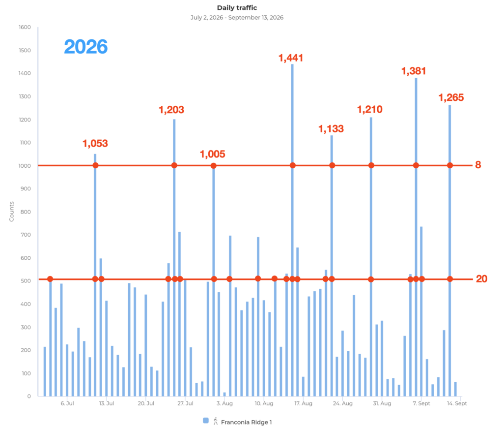
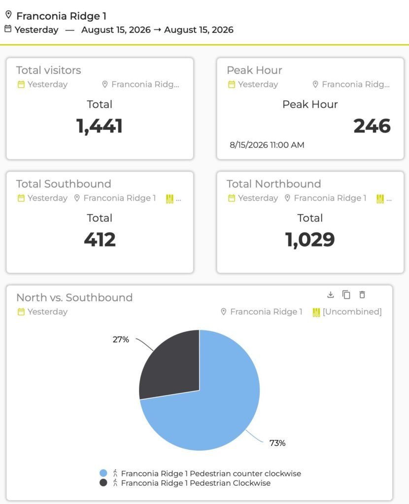
I had hoped we would see a lull after Labor Day. No such luck. On Saturday, September 12, the Franconia Ridge counter recorded 1,265 passes. We now also have the number for Labor Day Sunday: 1,381, close to the record-setting 1,441 recorded on August 15. Eight of the last nine weekends have now included a day with more than 1,000 passes.
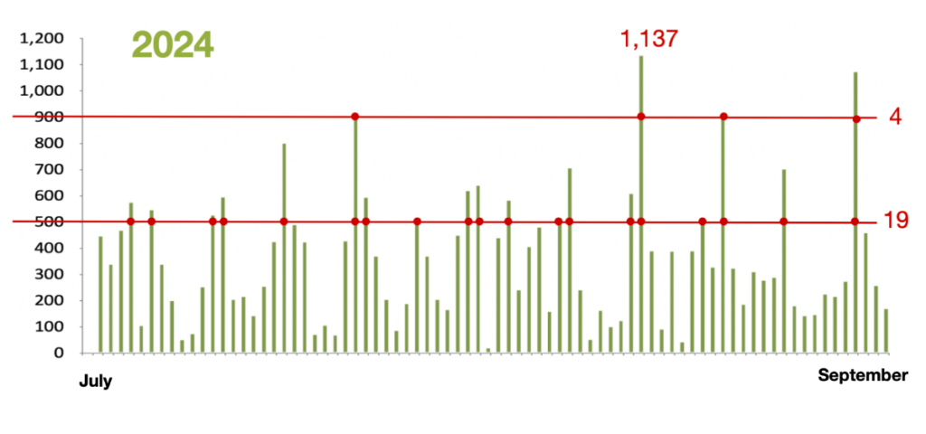
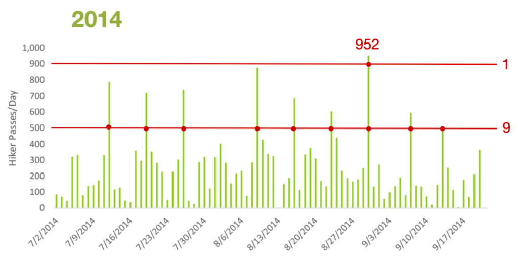
The graphs above put this change into perspective. During roughly comparable periods in 2014, 2024, and 2026, the number of days exceeding 500 passes increased from 9 to 19 to 20. But the more striking change is happening at the extreme end.
In 2014, only one day exceeded 900, topping out at 952. In 2024, four days exceeded 900, with one breaking 1,000 at 1,137. This year, eight days have exceeded 1,000, with our highest days reaching 1,203, 1,210, 1,265, 1,381, and 1,441.
Not many years ago, we thought of a 700-person day as extreme, something associated with a beautiful Fourth of July, Labor Day, or Indigenous Peoples’ Day weekend. Those extremes have steadily crept upward: 700 became 800, then 900, then 1,000. This summer we are repeatedly seeing 1,200 to 1,400.
The important point isn’t simply that there are more hikers.
The character of high-use days on Franconia Ridge is changing.
The Pulse Within the Wave
For years I have referred to the surge of hikers moving onto Franconia Ridge on busy mornings as “the wave.” Last year I explored this more formally through an analogy with fluid dynamics: hikers flow along the trail, gather in “eddies” at summits and viewpoints, encounter constrictions, and spill beyond the tread when the available space becomes insufficient.
Our new trail-counter data suggest another way of looking at the same system:
Franconia Ridge has a pulse.
Look at the daily graphs and you can see a rhythm. Use rises and falls through the week, followed by the great weekend pulse. Zoom into a single busy day using our new counter, which records hikers in 15-minute intervals, and another rhythm appears inside it. The morning wave builds toward midday, but that wave itself consists of smaller pulses and clusters of hikers moving across the Ridge.
There are rhythms nested within rhythms: the seasonal pattern, the weekly weekend pulse, the daily wave, and the smaller clusters within that wave.
The cardiovascular analogy is useful because a circulatory system isn’t affected by volume alone. Rhythm, flow, constriction, pressure, and the condition of the system itself all interact.
And that brings us to something we learned this summer that complicates our thinking.
Off-Trail Behavior: A More Complicated Picture
We had hypothesized that increasing crowding would produce a surge in off-trail behavior: as the number of hikers increased, the percentage stepping off the trail would rise sharply.
Students in this summer’s White Mountain Environmental Field School systematically observed off-trail behavior and compared those observations with our counter data.
The results did not demonstrate the surge we expected.
People went off-trail even at lower measured flow rates, and the percentage leaving the tread did not clearly increase with hourly visitation.
But those observations didn’t disprove the hypothesis either. Most of our observations occurred during generally high-use periods, so we never established a good baseline for truly quiet conditions. We were also comparing observations with hourly counts, which may conceal the very phenomenon we are trying to understand.
Forty hikers distributed relatively evenly across an hour are very different from thirty of those hikers arriving within ten minutes.
Clustering may matter as much as overall volume.
There is also another possibility: the threshold at which crowding begins to influence behavior may simply be much lower than we thought.
Even at relatively modest hourly counts, hikers move in groups. They meet parties traveling in the opposite direction. Faster hikers and runners overtake slower hikers. People stop to rest or take photographs. At a high step or narrow scramble, several people arriving together may temporarily exceed the effective capacity of that small piece of trail.
This makes the new 15-minute data particularly valuable. We need to look not only at the number of people using Franconia Ridge, but at the amplitude and rhythm of the pulsewith the wave.
A Cardiovascular System Under Stress
This brings us back to those extraordinary numbers from 2026.
A healthy cardiovascular system can accommodate changing demands. The heart beats faster, flow increases, vessels respond, and eventually the system returns toward normal.
But repeated extreme pulses acting upon a system with existing constrictions are another matter.
Franconia Ridge increasingly feels like a system under chronic cardiovascular stress.
The “arteries” themselves are compromised in places. Narrow scrambles, high steps, rough tread, poorly defined trail edges, and crowded summits create something analogous to stenoses, places where the available channel narrows.
People stop in the flow. Faster hikers and runners pass slower groups. Opposing traffic tries to negotiate the same narrow passage. Hikers accumulate. Eventually the stream spills sideways.
In the cardiovascular analogy, some of our trail work begins to look like medical intervention. Strategic widening opens constricted sections. Reconstructing excessively high steps can reduce places where hikers routinely go around obstacles. Better-defined tread helps keep circulation within the intended channel. Pullouts give people somewhere to rest, talk, eat, or enjoy a view without stopping in the main flow.
In a very loose sense, carefully widening a chronic pinch point is a little like placing a stent. We aren’t proposing to widen the entire Franconia Ridge Trail. We are identifying the places where circulation repeatedly breaks down and increasing capacity precisely where it is needed.
But no physician would treat serious cardiovascular disease simply by inserting more stents.
And we cannot build our way out of everything happening on Franconia Ridge.
When Extreme Use Becomes a Crisis
What does a 1,441-person wave mean when our observations suggest that off-trail behavior is already occurring at a fraction of that volume?
Perhaps these extraordinary days are analogous not simply to elevated blood pressure, but to an acute cardiovascular crisis imposed upon a system already experiencing chronic stress.
This is an analogy or metaphor, of course. But it provides a useful way of thinking about the condition of the Ridge. We have recurring extreme pulses, physical constrictions, a fragile surrounding environment, and indications that impacts occur well before we reach our most spectacular visitor counts.
There is also another part of the system that our automated counters cannot measure: human behavior.
Our Summit Stewards are encountering not simply more people, but increasingly difficult interactions. There have been instances of hikers and runners ignoring requests to remain on the trail, deliberately walking across fragile alpine vegetation after being asked not to, and responding rudely or defiantly to stewards trying to protect the Ridge.
That matters.
The effective capacity of a trail isn’t determined solely by its width, grade, and surface. It also depends upon how people behave within that space.
A thousand people who consistently remain on a well-defined tread present a very different management problem from a thousand people among whom a significant number cut corners, pass outside the tread, congregate on vegetation, or disregard stewardship messages.
So perhaps we need to think about the health of Franconia Ridge in terms of three interacting dimensions:
The pulse: How many people arrive, when they arrive, and how strongly they cluster.
The circulation: Whether the physical trail has sufficient capacity to move those people without expanding the human footprint into the surrounding alpine zone.
Behavior: How people move through the system and whether visitors respond to trail boundaries, stewardship, education, and the vulnerability of the landscape.
Seen this way, we are no longer simply managing a popular trail.
We are managing a trail system experiencing recurring episodes of extreme use in an extraordinarily fragile alpine environment, with signs that both its physical and social capacity are under severe strain.
I think it is fair to call that a crisis.
From Metaphor to Management
Calling something a crisis shouldn’t imply despair. It should change the urgency and scale of our response.
Some of that response can happen directly on the Ridge.
One possibility we are exploring is expanding the role and training of our Summit Stewards. Stewards spend hundreds of hours observing how people actually move across Franconia Ridge. They see where circulation repeatedly breaks down: high steps that hikers walk around, pinch points where passing forces people outside the tread, poorly defined trail edges, places where hikers repeatedly step onto vegetation, and summits and viewpoints where people need somewhere to get out of the moving stream.
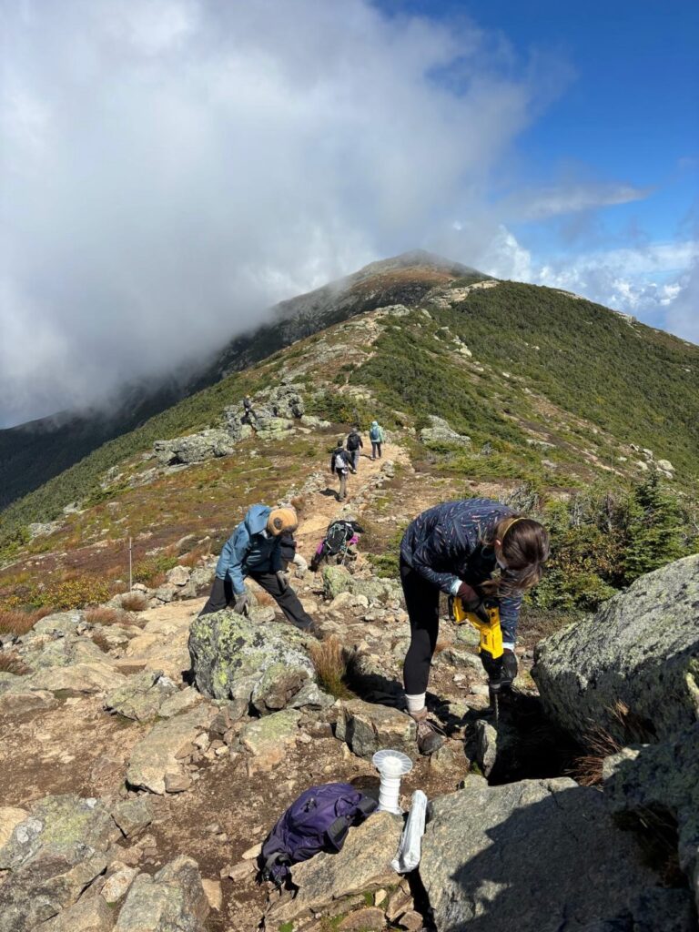
With additional training in trail reconstruction and stonework, Summit Stewards could devote part of their work week not simply to observing these problems, but to fixing them: reconstructing high steps, defining tread, strategically widening chronic pinch points, creating pullouts, installing appropriate barriers, and continually adapting the trail to what we are learning from visitor behavior.
That would represent an important evolution in alpine stewardship: education, observation, trail maintenance, restoration, and adaptive management becoming parts of the same job.
But that addresses only the circulation.
We also have to address the pulse.
When Franconia Ridge repeatedly receives 1,000 to 1,400 passes in a day, the U.S. Forest Service and New Hampshire State Parks need to seriously examine options for reducing or redistributing the largest pulses before they reach the alpine zone.
That conversation should include a range of possibilities: parking and transportation policies, some form of reservation, permit, or timed-entry system during periods of extreme use, and perhaps development of an attractive lower-elevation loop that provides less experienced hikers with an alternative to committing themselves to the entire Franconia Ridge Loop.
A lower loop could be particularly interesting because it isn’t simply a restriction. It creates another choice: a rewarding mountain experience more appropriate to the abilities, available time, or expectations of some of the people who currently enter the eight-mile alpine loop.
No single intervention is likely to solve the problem.
That is precisely the point of Integrated Trail Management.
We need to work simultaneously on the pulse, the circulation, and behavior within the system: moderate extreme volumes where necessary; improve the physical trail where constrictions create predictable impacts; provide alternatives where appropriate; and strengthen stewardship, education, and trail definition so visitors understand how to move through this extraordinarily fragile landscape.
The numbers from 2026 suggest that we have entered a different era on Franconia Ridge. A decade ago, a 700-person day could be considered extreme. This summer we have repeatedly exceeded 1,000 and reached 1,441. At the same time, our field observations suggest that off-trail behavior is not confined to those extraordinary days. The system may begin showing signs of stress at much lower levels of use than we previously assumed.
That changes the question.
We should no longer ask simply:
How many hikers can Franconia Ridge accommodate?
We should be asking:
What combination of visitor volume, trail design, visitor behavior, stewardship, and management will allow people to experience Franconia Ridge without continuing to expand the human footprint across the alpine zone?
The objective isn’t to stop the heart. We want people to experience these mountains.
The challenge is to restore a healthier pulse and build a trail and management system capable of sustaining it.
That is no longer an abstract discussion about carrying capacity. It is the management challenge now in front of us.
The Partnership to Restore the Franconia Ridge Loop did more than rebuild deteriorated sections of trail. At its best, it demonstrated a different approach to designing and constructing trails for the conditions we now face in the White Mountains.
Many of our steep legacy trails were laid out more than a century ago, when use was dramatically lower and our understanding of sustainable trail design was very different. Today, the Franconia Ridge Loop receives 45,000–50,000 visitors between May and October, while increasingly intense rain events put additional stress on trails already carrying extraordinary levels of foot traffic.
Repairing these trails in place is no longer enough. Many White Mountain trails need to be fundamentally redesigned to reflect the realities of terrain, geology, ecology, and steadily increasing visitation. At the same time, trail design must recognize the diverse ways people move through the landscape today, whether hiking, trail running, mountain biking, or using mobility devices such as wheel chairs. Sustainable trails must be resilient not only to natural forces, but also to the evolving ways people experience the outdoors.
Here are some of the things I believe the Franconia Ridge Loop project got right.
Trail Realignment
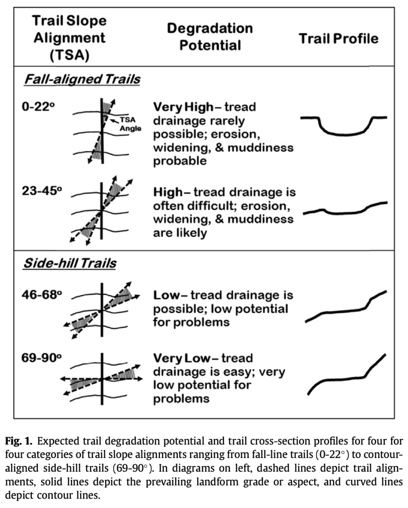
Many of the White Mountains’ steep legacy trails follow, or come close to following, the fall line, the direction of steepest descent down a slope. Unfortunately, that is also the direction water wants to travel.
At relatively low levels of use, these trails can persist for a very long time. As I discussed in my essay Trails and Time, however, at moderate and especially high levels of use, the combination of water and thousands of boots accelerates erosion. The result is familiar throughout the White Mountains: trails that gradually become deeply eroded channels filled with exposed rocks and roots, with sediment carried downslope toward streams and rivers.
The most important solution is often not to keep repairing the old trail, but to change its alignment.
By moving a trail onto the side slope and allowing it to climb more gradually across the contour, we can dramatically reduce the distance that water travels down the tread and create opportunities for water to leave the trail naturally. A properly designed side-hill trail is consequently less susceptible to erosion and requires less intensive maintenance.
That sounds simple. In practice, on the steep, rocky terrain of Franconia Notch, it is anything but.
Reverse-Grade Drainage
Realignment by itself does not solve the drainage problem. Even a side-hill trail has a grade, and water will follow that grade downhill unless we give it somewhere to go.
Traditionally, White Mountain trails have relied heavily on waterbars: stone or wooden structures placed across the trail to intercept water and divert it from the tread. Properly constructed and maintained, they can work. The problem is that waterbars collect sediment and debris and therefore require frequent cleaning.
That creates an enormous maintenance burden. A steep legacy trail can require scores or even hundreds of drainage structures, some needing attention multiple times during a season. With increasingly intense rain events, keeping every drainage structure functioning becomes extraordinarily difficult. We should not blame trail adopters and trail crews when that system begins to fail. We should ask whether we can design trails that require less intervention in the first place.
One of the most important techniques used in the Franconia Ridge project is therefore reverse-grade drainage.
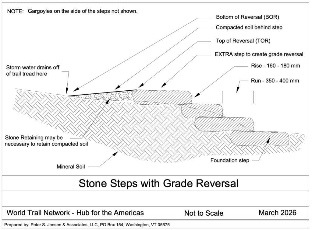
Instead of continuously climbing, the trail briefly levels and descends before beginning to climb again. This creates a natural low point where water can leave the trail. Combined with an appropriately outsloped tread, water drains from the trail largely through its shape, rather than depending upon a structure that must continually be cleaned.
The best drainage structure, in other words, can be the trail itself.
Using Steps Without Building a Staircase Up the Mountain
There is a complication.
An ideal side-hill trail with frequent grade reversals can require a great deal of horizontal distance to gain elevation. In the convoluted, rocky terrain of the White Mountains, we simply do not always have that space.
Many modern professional trail builders therefore regard stone steps as something to use judiciously rather than as the first solution to a steep slope. But avoiding steps entirely can require very long realignments, while simply building a staircase straight uphill recreates many of the drainage problems we are trying to solve.
The Franconia Ridge project has demonstrated an important compromise.
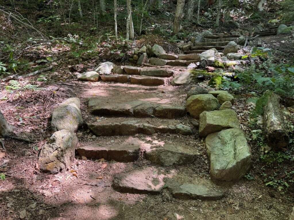
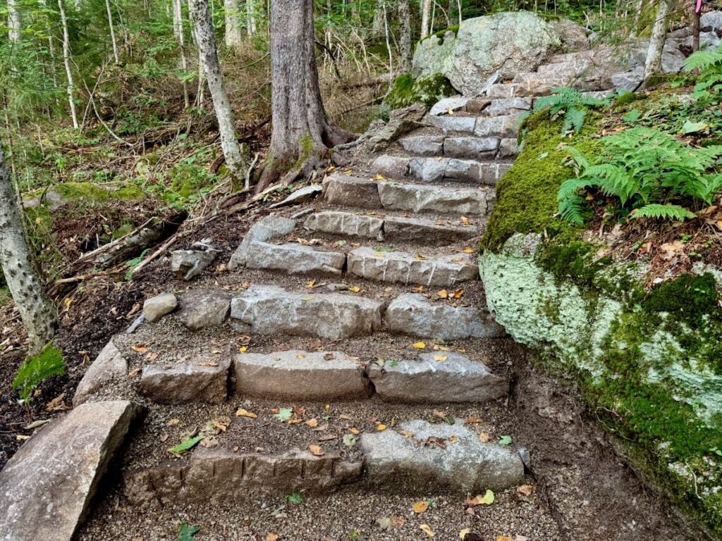
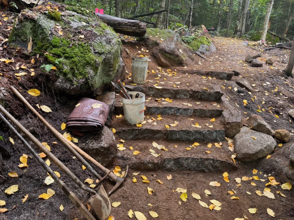
Rather than constructing long, continuously steep staircases, we can use small clusters of stone steps to gain elevation relatively quickly, followed by longer sections of trail at a much lower grade, often around 10–12 percentwhere the terrain permits. A reverse grade can be incorporated at the top of a step cluster before the trail resumes climbing.
These combinations can often be incorporated into a climbing turn, allowing the trail to gain substantial elevation while maintaining sustainable grades and drainage over most of its length.
Professional trail builder Peter Jensen has refined this approach over many years, and it has been used extensively in the Franconia Ridge Loop restoration.
The result is not a trail without steps. It is a trail in which steps, grade and drainage work together.
Steps Designed for Human Beings
Stone steps have been part of the White Mountain trail-building toolbox for decades. What has not always received enough attention is their rise and run: how high hikers must step and how much usable surface each step provides.
The White Mountains are famous for what are sometimes called “power steps” or “Paul Bunyan steps.” I confess that as a young trail builder, I helped build them. There was almost an assumption that hikers should have to make an extra effort to get up the mountain.
But hikers and trail runners respond to the trail in front of them. Faced with an awkwardly high step and an easier route around it, many people will unconsciously choose the easier route. Multiply that decision by tens of thousands of hikers and the result is widening, braiding and erosion alongside the constructed trail.
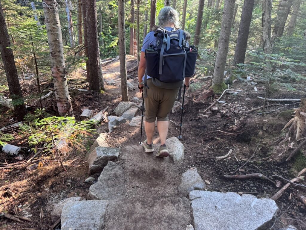
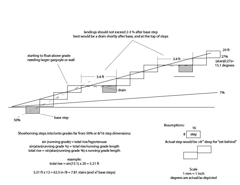
On the Franconia Ridge project, we have increasingly aimed for stone steps with a comfortable rise of no more than about 7–8 inches and, where the available stone allows, a run of roughly 14–16 inches.
That isn’t merely about making hiking easier.
A trail people naturally want to walk on is also a trail they are more likely to stay on.
Foundation Steps
Good stone stair construction begins at the bottom.
A secure foundation step at the foot of a stair cluster is essential. Without it, erosion can undermine the bottom of the staircase and destabilize everything above it.
This matters particularly because steep trail sections concentrate and accelerate water. The principle is straightforward: the steeper the grade, the faster water can flow; the faster it flows, the greater its erosive power.
We can see the consequences on older sections of both the Old Bridle Path and Falling Waters Trail. Some stone steps have been undercut by more than a foot. That represents an extraordinary amount of lost soil, but it also changes the effective height of the step. A once-manageable stone step gradually becomes another “Paul Bunyan step,” encouraging hikers to find a route around it.
A well-founded staircase, combined with drainage that keeps water from accelerating through it, is therefore fundamental to durable stonework.
Full-Bench Construction, Cribbing and Tread Preparation
A sustainable side-hill trail also requires a proper bench cut.
Rather than placing tread material on the surface of a slope, the trail is cut into the hillside to create a stable walking surface. Wherever terrain permits, a full-bench trail, with the entire tread excavated into undisturbed mineral soil, provides the strongest foundation.
On a lightly used trail, a relatively modest tread may gradually become established through use. That is not adequate for a trail carrying tens of thousands of hikers each year.
The organic surface layer must be removed and the tread prepared with suitable mineral soil and crushed aggregate where necessary. On our Old Bridle Path work, we sometimes literally mine the material, digging small pits nearby to find appropriate mineral soil and aggregate.
Skipping this step may produce a trail that looks finished when the crew leaves, but heavy traffic will quickly compact and displace organic material, exposing roots and rocks. Placing heavier mineral material directly over an unsuitable organic layer doesn’t solve the problem either. The underlying organic material eventually mixes upward into the tread, creating a soft, muddy and unstable surface.
Where the hillside is too steep to support the desired tread width through benching alone, stone cribbing can retain the outside edge, allowing the space behind it to be filled with suitable mineral material and creating a durable, stable tread.
Much of the quality of a trail, in other words, lies beneath hikers’ feet where they will never see it.
A Trail Width That Reflects Actual Use
One of the most visible changes on reconstructed sections of the Franconia Ridge Loop is that the trail is sometimes wider than the trail it replaced.
At first, that can seem counterintuitive. Isn’t the goal to make the trail’s footprint as narrow as possible?
Not necessarily.
On a trail carrying 45,000–50,000 visitors a year, people regularly meet and pass one another. If the constructed tread is too narrow for that behavior, hikers step onto its edges and into adjacent vegetation. The effective trail becomes wider regardless of what width appears on the construction plan.
Forest Service trail standards allow considerable variation in tread width depending upon trail class, designed use, terrain and management objectives. On portions of the Franconia Ridge Loop, we have used tread widths of up to approximately 60 inches, particularly where accommodating two-way traffic helps keep hikers on the constructed surface.
That leads to an important principle for heavily traveled trails:
Sometimes a somewhat wider constructed trail creates a smaller overall area of disturbance.
The trail should be designed not simply for an abstract standard, but for the way tens of thousands of people actually use it.
Toward a New White Mountains Standard
These are not all of the sustainable design and construction techniques used in the Partnership to Restore the Franconia Ridge Loop. But together they represent something larger than a collection of trail-building details.
They represent a change in philosophy.
Rather than repeatedly repairing a century-old trail in place, we can design the trail around water. We can use alignment and grade to shed water before it gains erosive force. We can use stone steps strategically rather than simply building straight uphill. We can construct steps that people naturally want to use. We can build a durable foundation beneath the tread. And we can make the trail wide enough to accommodate the number of people who actually hike it.
Perhaps most importantly, the project has demonstrated that heavily used White Mountain trails require a different standard of design and construction than trails receiving a few thousand visitors a year.
The Partnership to Restore the Franconia Ridge Loop has made an enormous contribution toward establishing that standard.
But if this is the standard we now know how to build, another question follows:
Did we apply it consistently across the Franconia Ridge Loop, and what have we learned about how to do better?
That will be the subject of the third and final article in this series: What We Could Have Done Better in the Franconia Ridge Loop Project.
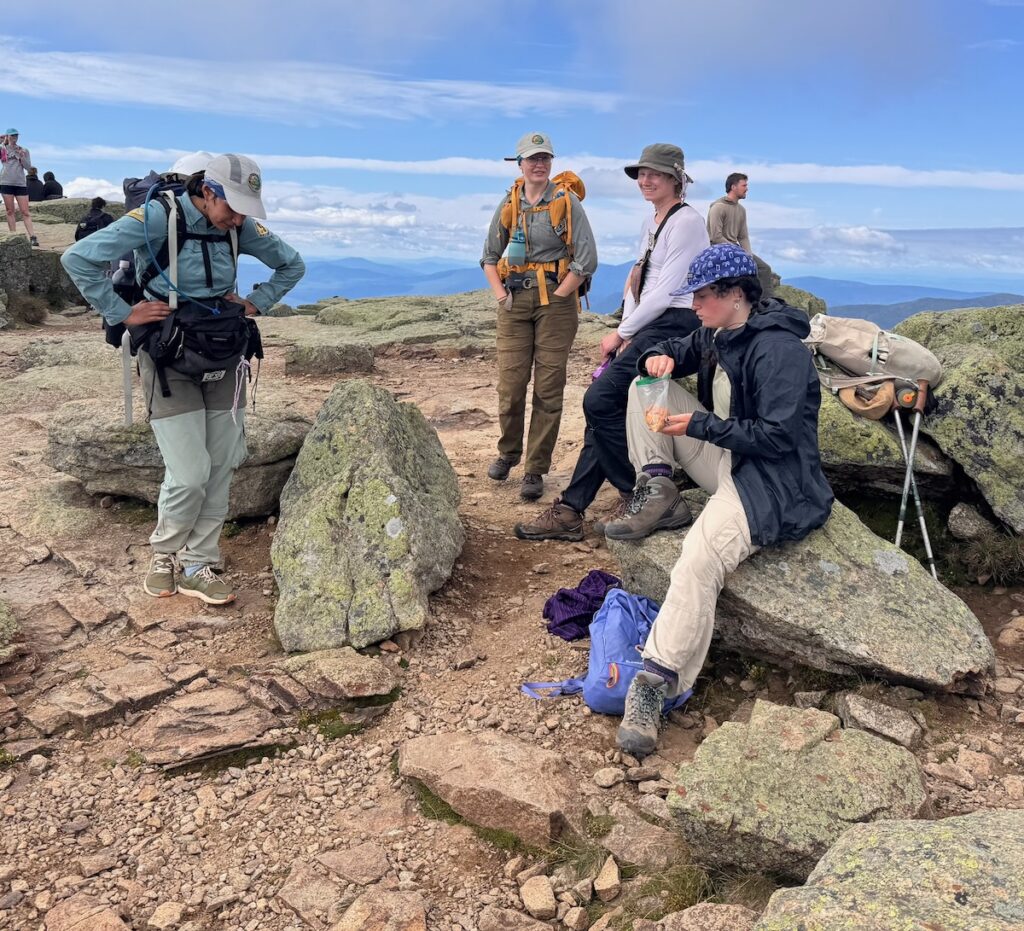
This weekend, Summit Stewards Kenna Brochu and Demi Terry and Summit Steward Intern Sarah Heller traversed up to Franconia Ridge for Labor Day Weekend. This weekend we anticipated a large population of hikers, so we were eager to get up to the ridge and start working.
On Friday, September 4th, we were surprised by the lack of hikers spending the night at Greenleaf Hut. The hut was only around half full, which was very unexpected. Nonetheless, we met up with AMC Alpine Steward Pete Lane, who was stationed at Greenleaf Hut, and discussed our stewarding plan for the busy Saturday.
On Saturday, September 5th, the weather was less than ideal. It was a very cold and gloomy morning in the clouds, but we knew that the conditions weren’t going to stop hikers from traversing the ridge. Sarah and I traversed over to Little Haystack to spend the day stewarding. On the way, we stopped at each summit for around 30–45 minutes and talked to multiple different groups of hikers about their plans. We arrived at Little Haystack around 12:30pm and remained stationed there until around 3:30pm. Although busy, the flow of traffic was relatively mild, and the summit never felt overwhelmingly busy like it can on a typical Saturday.
On this day, Demi hung back and continued building up scree walls along the south side of Lincoln in hopes of keeping hikers on trail during this busy weekend.
At the end of the day, Sarah and I met Demi at the summit of Mount Lafayette and stayed there for around an hour. We like to end our day stewarding on Mount Lafayette in hopes of guiding hikers to the right trail when following the Franconia Ridge Loop. We have noticed an increase in hikers continuing on the Appalachian Trail towards North Lafayette instead of turning left down the Upper Greenleaf Trail. We believe that additional signage or reworking the current sign would help guide people in the right direction.
On the descent down the Upper Greenleaf Trail, the rain began to pick up. Thankfully, we noticed most hikers coming to the ridge were very prepared with rain gear and layers.
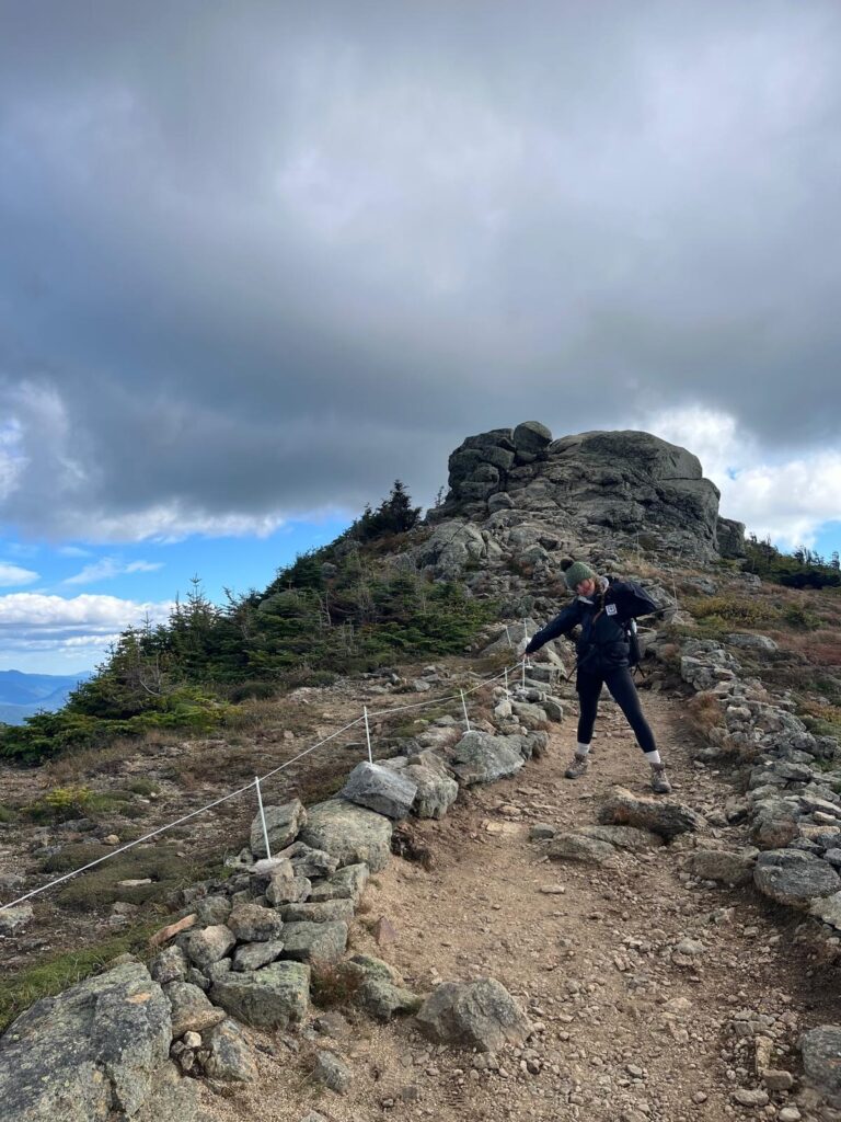
On Sunday, September 6th, the plan was to head to the south side of Mount Lincoln to continue to work on the rock project from the previous week. Sarah and Demi continued working on the project while I installed more string fencing on the north side of Mount Lincoln. Although we have worked tirelessly this season to perfect the scree walls in this region, unfortunately these efforts have not been successful in keeping hikers on trail. While installing string fencing, multiple hikers were curious about the project and appreciated the efforts of maintaining the trail.
Unfortunately, Demi and Sarah had to stop working on the rock project relatively early due to the amount of traffic on the ridge that day. Instead, Sarah decided to steward on Mount Lincoln, while Demi traversed back to Mount Lafayette to steward there. The digital trail counter was malfunctioning this weekend, so we unfortunately will not have an exact count of hikers traveling the ridge on Sunday, but I can confidently say that this is one of the busiest days I have seen this season.
After finishing the string fencing installation, I joined Sarah at the summit of Mount Lincoln and talked to various hikers for around an hour.
On our traverse back to the hut, I noticed a hiker in distress on the south side of Mount Lafayette, around 100 feet from the summit. She was in her late 20s and had been abandoned by the group she was hiking with. She stated that she was in no intense pain but felt like she had breached her physical limits. When I met her, she had already notified Search and Rescue that she needed assistance. Fortunately, Pete wasn’t far behind and was able to contact Fish and Game to make a plan. Pete, Demi, and I hiked with her over the summit and down the Upper Greenleaf Trail to Greenleaf Hut. We were under the impression that some of her group was waiting for her at the hut, where we would drop her off with them. Unfortunately, her friends began the traverse without her, down the Old Bridle Path. So, we got in contact with her friends and asked them to stop hiking so we could meet them and allow the group to finish the traverse together.
It was around 7:00pm when Demi and I started hiking the woman down the Old Bridle Path. Fortunately, the hut had two headlamps they were willing to donate to the group. At around 8:30pm, we found her friends waiting, roughly a mile and a half down the trail. We reminded them that it is never a good idea to split up in the backcountry and situations like these can become extremely dangerous extremely fast. After talking for a bit, they started their hike back down the trail, while we started traversing back to the tent platform. We got back to the hut around 9:15pm.
On Monday, September 7th, we were all feeling pretty exhausted from the long day on the ridge and decided to just traverse up to Mount Lafayette. Demi and Sarah started working on extending the walls leading to North Lafayette in hopes of reducing the confusion at the fork. I worked on rebuilding cairn tops leading to the summit of Mount Lafayette. This day was also extremely busy, with a full crowd on the summit as early as 10:30am. At around 1:00pm, we began our trek back down Upper Greenleaf to begin our pack out.
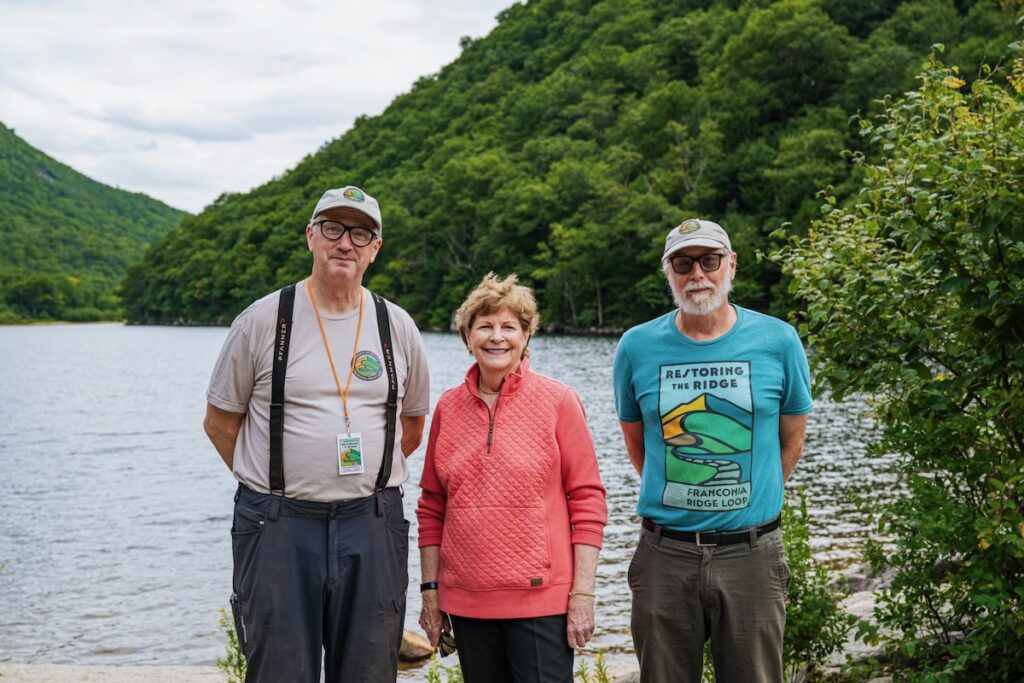
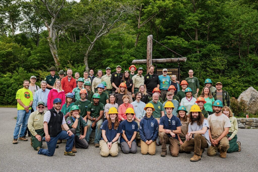
Sept. 1, 2026. Franconia Notch State Park, New Hampshire — Celebratory event to mark 5 years of the Franconia Ridge Restoration Project. AMC staff and project partners with US Senator Jeanne Shaheen. Photo by Amanda Maria Garza.
On Tuesday, September 1, groups gathered in Franconia Notch to celebrate five years of the Partnership to Restore Franconia Ridge, marking the conclusion of trail work supported by Congressionally Directed Funding secured by U.S. Senator Jeanne Shaheen and led by the Appalachian Mountain Club (AMC).
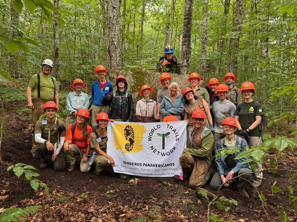
Representatives of WTN Americas/Pan American Trails were also invited and attended. Although our work was not supported by the Congressionally Directed Funding, it has become an important part of the larger effort to restore the Loop.
Sept. 1, 2026. Robert White, Jeanne Shaheen, and Nat Scrimshaw. Photo by Amanda Maria Garza.
The congressional funding did not cover the portions of the Old Bridle Path and Falling Waters Trail located on Franconia Notch State Park lands. WTN Americas/Pan American Trails secured private funding to extend the restoration effort into these sections. Our professional crews, Peter S. Jensen & Associates LLC and the Trail Fixing Collective LLC, have worked extensively on the Old Bridle Path and continue that work today. This year, private support is being supplemented by a New Hampshire Recreational Trails Program grant.
Altogether, WTN Americas/Pan American Trails has brought over $600,000 in additional funding to the Franconia Ridge Loop effort, representing more than one-third of the investment in the entire project. And our work will continue beyond the conclusion of the congressionally funded project. In 2027, we plan to move restoration work to the Franconia Notch State Park section of Falling Waters Trail.
The Work Still Ahead
As we celebrate what has been accomplished, this five-year milestone also provides an opportunity to take stock.
The original vision was ambitious: to “redesign the Franconia Ridge Loop from start to finish.” Five years later, despite an extraordinary investment of money, labor, expertise, and volunteer effort, that work is not complete.
Substantial work remains even on the two approach trails, Old Bridle Path and Falling Waters Trail. Only a relatively small amount of work has been completed on the upper Greenleaf Trail in the alpine zone. And no congressionally funded restoration work was undertaken on perhaps the most ecologically sensitive section of the entire Loop: the Franconia Ridge Trail between Mount Lafayette and Little Haystack.
WTN Americas/Pan American Trails Summit Stewards have undertaken substantial trail tending and restoration work along this alpine section, but without support from the Congressionally Directed Funding and therefore outside the formal restoration project.
2026. WTN Americas/Pan American Trails Summit Stewards resetting steps on the Franconia Ridge Trail.
In other words, after five years and a tremendous investment, we have learned something important about the scale of the challenge:
If our goal is to truly restore and sustainably manage the Franconia Ridge Loop, the work has only begun.
That does not diminish what this partnership has accomplished. Quite the opposite.
The project represents a major advance in promoting a new standard for trail design and construction in the White Mountains. It has demonstrated what becomes possible when significant resources, skilled professional crews, public agencies, nonprofit organizations, and volunteers are brought together around a shared project.
It has also given us lessons that should inform how projects are planned and designed; how priorities are established across an entire trail system; how professional and volunteer crews can best complement one another; and how trail reconstruction can be integrated with the ongoing stewardship required after the construction crews leave.
2026. Volunteers working on the the Franconia Notch State Park section of the Old Bridle Path.
Our Old Bridle Path volunteer workdays, organized in partnership with AMC, offer one example. In my experience, they represent one of the most effective integrations of volunteer labor into a professional trail construction project I have seen. Volunteers are not simply doing work adjacent to the professional project. Their work is planned so that it directly advances and complements what the professional crews are building.
However, the work does not end when a grant ends. Nor does rebuilding the physical trail, by itself, solve the challenges facing Franconia Ridge. Summit stewardship, routine trail tending, ecological restoration, visitor management, monitoring, and continued reconstruction all have to become parts of a sustained effort.
So, as this five-year chapter comes to a close, where do we go from here?
Next week we will, we will consider: Franconia Ridge Loop restoration beyond 2026.
One of the questions we have been asking over the last several years: When does a busy trail become a crowded trail?
The trail counter on Franconia Ridge provides part of the answer. It records the number of visitors passing a point on the ridge and, importantly, the direction they are traveling. Looking at the data by hour reveals a remarkably consistent daily rhythm. Visitor traffic builds rapidly through the morning, generally peaks between 11:00 a.m. and 1:00 p.m., and then declines through the afternoon.
But not all days are alike. Saturdays operate in an entirely different realm from most weekdays. During the summer we recorded several Saturdays with more than 1,000 visitors. On August 15 the trail experienced a record 1,441 visitors in a single day—a record number. This last Saturday, August 22, we also exceeded 1000, with 1133. Our observations suggest that under these very high-use conditions, off-trail behavior also increases sharply.
The new counter WTN Americas/Pan American Trails placed on the ridge this summer can provide data at 15-minute intervals, allowing us to look inside those busy hours. What we find is that visitors do not necessarily move across the ridge in a steady stream. They often arrive in small waves or pulses within a larger single wave , not unlike the traffic patterns that develop on a highway during periods of congestion.
On August 15, for example, one 15-minute period contained 73 visitors and another contained 75. More importantly, the pressure was sustained. For nearly five hours, every consecutive 15-minute interval contained at least 35 visitors, and for four hours the count remained at or above 40 per interval.
Volume, Intensity, Persistence, Encounters, and Passing
This suggests that crowding has several dimensions. Daily volume tells us how many people are using the trail. Intensity tells us how concentrated that use becomes over short periods. Persistence tells us how long those conditions continue.
Intensity can occur without high volume; persistence generally cannot. A large group, or simply the happenstance of several groups arriving at the same time, can create a short burst of intense use on an otherwise quiet day. But for high-intensity conditions to persist over hours, there must be enough visitors in the system to continually replenish the flow.
Because the counter records direction of travel, we can also distinguish visitors traveling north from those traveling south. When visitors traveling in opposite directions meet, we call these encounters. Two 15-minute periods containing 60 visitors therefore may represent very different conditions. If nearly everyone is traveling in one direction, there will be relatively few opportunities for head-on encounters. If 30 are traveling north and 30 south, the potential for encounters is much greater.
There is another kind of interaction: passing. Visitors traveling in the same direction move at different speeds, so faster visitors overtake slower ones.
Both encounters and passing matter because trail conditions help determine what happens when visitors interact. On a wide, relatively smooth section of trail, two visitors may pass without difficulty. At a narrow section, high step, rugged scramble, pinch point, or location where the trail boundary is unclear, the same interaction may require someone to stop, wait, squeeze past, or step off the established tread.
It becomes more complicated when we consider different types of visitors. In 2025, International Trails Fellow Rod Goés observed differences in interactions involving hikers and runners. When hikers approach one another from opposite directions, one or both may move off the tread to get by. When a hiker sees a runner approaching from the opposite direction, however, the hiker may stop and step aside, often onto a durable surface. A runner overtaking a hiker from behind presents a different situation: the hiker may not know the runner is approaching, leaving the runner to move around the hiker, sometimes in a broad arc beyond the established tread.
This gives us a more nuanced way of thinking about the relationship between visitor use and trail impacts:
visitor flow → encounters & passing → interaction with visitor type & trail conditions → behavioral response
The Importance of a Trail Audit
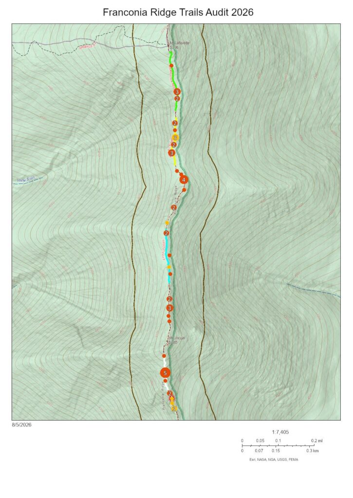
The White Mountain Environmental Field School’s trail audit adds another part of the information needed to understand this process. In 2026, students and stewards mapped many of the physical conditions associated with off-trail movement, including high steps, narrow tread, pinch points, rugged surfaces, and poorly defined trail boundaries. They also identified locations where off-trail use is already occurring.
Bringing these observations together with the counter data may allow us to test a more interesting hypothesis. Off-trail behavior may not simply increase steadily as the number of visitors increases. Instead, there may be points at which repeated encounters and passing at particular locations begin to produce surges in off-trail movement.
One visitor steps aside to let another pass. A second person follows the same line. As traffic continues, what began as an individual response can become an informal passing lane or alternate route. In this way, a combination of visitor flow, human behavior, and trail design may produce impacts that cannot be explained by visitor numbers alone.
Modeling Visitor Behavior
How can we put all these pieces together? One promising tool is an agent-based model, or ABM. The idea is simpler than the name suggests. Instead of treating 1,000 visitors as a single number, a computer model represents them as individual visitors moving along a simplified version of the trail. Some travel north, others south. They move at different speeds, encounter and pass one another, and eventually respond to features such as narrow tread, high steps, or pinch points. The model can use the actual waves of northbound and southbound visitors recorded by our trail counter rather than assuming that visitors arrive at a constant rate.
We can then ask whether relatively simple rules governing individual behavior produce the larger patterns we observe on the ridge. Do off-trail movements begin to cluster at particular locations as traffic increases? Do short pulses of visitors matter differently from sustained congestion? What happens when opposing streams of visitors meet at a pinch point? And could widening a short section of tread, providing a passing area, clarifying a trail boundary, or changing a high step reduce the predicted off-trail surge?
An ABM would not tell us exactly what every visitor will do, nor would it replace observations on the ground. Instead, it provides a kind of virtual trail laboratory where counter data, trail conditions, and field observations can be brought together and different explanations tested. If the model can reproduce patterns we actually observe on Franconia Ridge, we can then use it to explore how relatively small changes in trail design or management might change those patterns.
Ultimately, the question is not simply “How many visitors are too many?” A more useful question may be:
Under what combinations of visitor flow, encounters, passing, visitor types, and trail conditions does off-trail behavior begin to increase?
Answering that question could help us move beyond broad ideas of trail “carrying capacity” toward something much more practical: understanding how heavily used alpine trails function under pressure, identifying where problems are most likely to develop, and designing targeted interventions that accommodate visitors while better protecting the alpine landscape.
Summit Steward Demi Terry and Summit Steward Intern Sarah Heller ranged a little farther than usual this past weekend, with four days of stewardship taking them from Franconia Ridge to Mount Moosilauke and the Crawford Path, with a stop along the way at the Dartmouth Trails Partners Dinner.
On Friday, August 21, Sarah stewarded the entire Franconia Ridge Loop, ascending Falling Waters Trail and spending the day talking with hikers along the route. She also connected with AMC Alpine Steward Kristi Kienholz based at Greenleaf Hut. After several exceptionally busy summer weekends on the ridge, Sarah reported a comparatively quiet day. However, the trail counter recorded another 1133 the following day, Saturday August 22.
A Day on Moosilauke
On Saturday, Sarah and Demi shifted their attention westward, climbing Mount Moosilauke to spend the day working alongside Dartmouth Alpine Steward Duda Gonçalves Freitas.
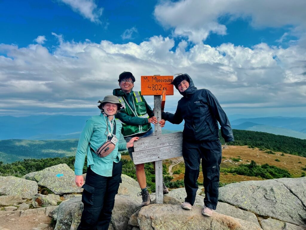
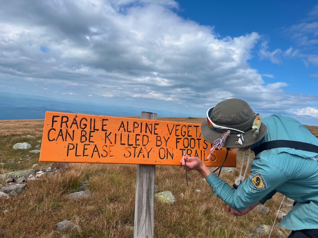
The three stewards repainted trail signs and talked with hikers throughout the day. In contrast to Franconia Ridge the day before, Moosilauke was bustling, giving Sarah and Demi an opportunity to see stewardship on another of the White Mountains’ heavily visited alpine summits.
That evening, Sarah and Demi attended the Dartmouth Trails Partners Dinner, where they met and exchanged ideas with people representing different corners of the White Mountains trail community. Beyond simply being a social gathering, the dinner provided an opportunity to learn about other projects underway across the region and strengthen connections among the organizations and volunteers caring for the White Mountains trail system.
Back to Work on the Crawford Path
On Sunday, the stewards turned east again, ascending the Edmands Path to begin a two-day hitch on the Crawford Path.
Much of Sunday’s work focused on the large disturbed area near Mount Franklin that we have come to call “the beach.” This broad area of exposed ground has been a recurring focus of our Crawford Path stewardship this summer.
Sarah and Demi also replaced sections of black string fencing with the more visible and durable white string fencingrecently introduced on Franconia Ridge. On their return toward Nauman Tentsite, they maintained scree walls along the route.
Monday took them north toward Mount Eisenhower, restoring fallen cairns along the way. One of their principal objectives was to begin rebuilding the cairn on Eisenhower’s summit. But when they arrived, they discovered something unexpected: someone had already rebuilt it.
The mystery remains as to who did the work. Demi reported that the cairn appeared to be well constructed, suggesting that it may have been rebuilt by a volunteer or caretaker..
The day also provided another reminder of how many people and organizations contribute to caring for these mountains. Sarah and Demi encountered numerous AMC volunteers along the route, as well as AMC’s Craig Heinselman.
Over four days, the stewards moved through three different alpine stewardship landscapes: interacting with visitors on Franconia Ridge, working alongside a Dartmouth steward on Moosilauke, and carrying out restoration and maintenance on the Crawford Path. It was an unusually wide-ranging weekend, but one that illustrates an increasingly important part of the Alpine Stewardship Center’s work: connecting stewardship across trails, mountains, and organizations throughout the White Mountains and Northeast.
On the Old Bridle Path this summer, one of the most important parts of the work has been bringing professional trail builders, volunteers, partner organizations, and different kinds of expertise together around a common design.
This is the fourth year of WTN Americas/Pan American Trails’ work on the Old Bridle Path in Franconia Notch State Park. Through the Alpine Stewardship Center, WTN Americas/Pan American Trails is sponsoring and overseeing the continuing reconstruction of the trail. Our professional trail crews, Peter S. Jensen & Associates LLC and Trail Fixing Collective LLC (TFC), have been tackling the technically demanding construction: building clusters of stone steps, rock cribbing, reverse grade drainages, and, in some places, armoring the tread with tightly fitted, almost Inca-like stone paving.
But professional construction is only part of the story.
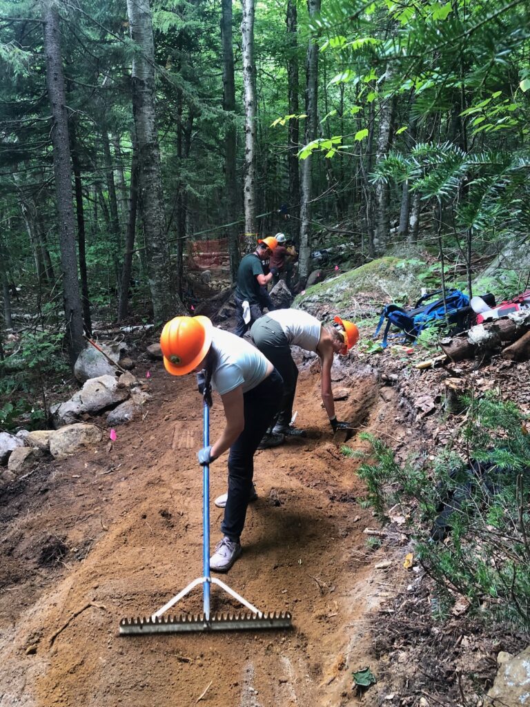
This season we have also sponsored ten volunteer trail days in partnership with the Appalachian Mountain Club, under the project leadership of Robert White. These workdays have become an integral part of the construction process, with volunteers preparing trail corridor, moving enormous quantities of mineral soil and rock, excavating roots, benching and grading tread, and completing work that allows the professional builders to concentrate their time and specialized skills where they are most needed.
The partnership plays to the strengths of both organizations. WTN brings its focus on sustainable trail design and professional trail construction, while AMC brings decades of experience recruiting, organizing, training, and leading volunteers. Rather than operating as two parallel efforts, the professional and volunteer crews have increasingly worked as parts of the same construction sequence.
The last two volunteer days show just how much that can accomplish.
Dirt, Roots and Rock: Volunteer Day #8
On August 15, 15 volunteers and three staff spread out across several sections of the Old Bridle Path.
One crew tackled what might best be described as the trail’s underground nervous system, removing approximately 100 feet of dense root mat with sawzalls, pick mattocks, and grubbing tools. Volunteers then benched and regraded roughly 150 feet of tread, preparing it for future resurfacing.
Elsewhere, the day’s work became a bucket brigade. Volunteers moved approximately 350 gallons of mineral soil onto the trail and used it to resurface and finish about 35 feet of tread.
Meanwhile, a crew led by Ken worked on Relocation #3, placing an extraordinary 1,000 gallons of mineral soil for future grading and resurfacing and collecting large rocks that will eventually become crib walls and other trail structures.
None of these jobs stands alone. Soil has to be found, excavated, moved, and staged. Rocks have to be gathered before they can be built into structures. Roots and organic material have to come out before durable mineral tread can go in. The finished trail may eventually look simple, but underneath that simplicity is a remarkable amount of coordinated labor.
Punching Through: Volunteer Day #9
A week later, on August 22, 12 volunteers and two staff returned for the ninth workday of the season.
This time, one crew concentrated on renovating approximately 70 feet of the existing Old Bridle Path, removing rocks and roots, filling voids with fresh soil, and more clearly defining the tread. Renovating an old trail can be less predictable than constructing a new one. Once the digging starts, roots, buried rocks, soft spots, and other surprises emerge from beneath decades of use.
On Relocation #4, volunteers discovered and opened two new mineral-soil pits, excavating and transporting more than 450 gallons of soil. They also produced more than six cubic feet of crushed rock for filling voids beneath the finished tread, then benched and graded another 45 feet of trail.
By the end of the day, Relocation #4 had been punched through to the old trail, an important milestone in connecting the new construction.
A smaller three-person crew continued work on Relocation #3, moving another roughly 450 gallons of mineral soiland producing at least six cubic feet of crushed rock for the developing tread and crib wall.
Add the two days together and the scale becomes easier to see: hundreds of feet of trail prepared or renovated, large quantities of rock gathered and crushed, and more than 2,000 gallons of mineral soil moved by hand.
That is a lot of buckets.
One Trail, Many Hands
Perhaps the most encouraging part of this season has been how seamlessly the volunteer effort has complemented the work of the professional trail builders.
The professional crews provide the technical expertise necessary for the Old Bridle Path’s more complex structures and for translating sustainable trail design into stone and soil. Volunteers greatly expand what can be accomplished around that work: opening corridor, preparing tread, excavating and transporting materials, rehabilitating existing trail, and advancing relocations so that professional builders can move efficiently from one technical challenge to the next.
The result is not professional trail building on one side and volunteer trail work on the other. Increasingly, it is one trail-building effort, with different crews contributing different skills to the same project.
The tenth and final scheduled AMC-WTN volunteer workday of the season is September 5, but that will not mark the end of this year’s construction. Our professional crews will continue working on the Old Bridle Path into October.And while four years of work have been concentrated on the Old Bridle Path, the larger effort is beginning to move around the Franconia Ridge Loop: next year we plan to begin work on the New Hampshire State Parks section of the Falling Waters Trail.
In the next Raven, we’ll turn our attention more fully to the professional side of the work: the stone steps, crib walls, armored tread, and other structures gradually transforming this heavily traveled White Mountain trail.
For now, though, it seems appropriate to celebrate the volunteers who have supplied the buckets, mattocks, muscles, persistence, and many hundreds of gallons of dirt that make that transformation possible.
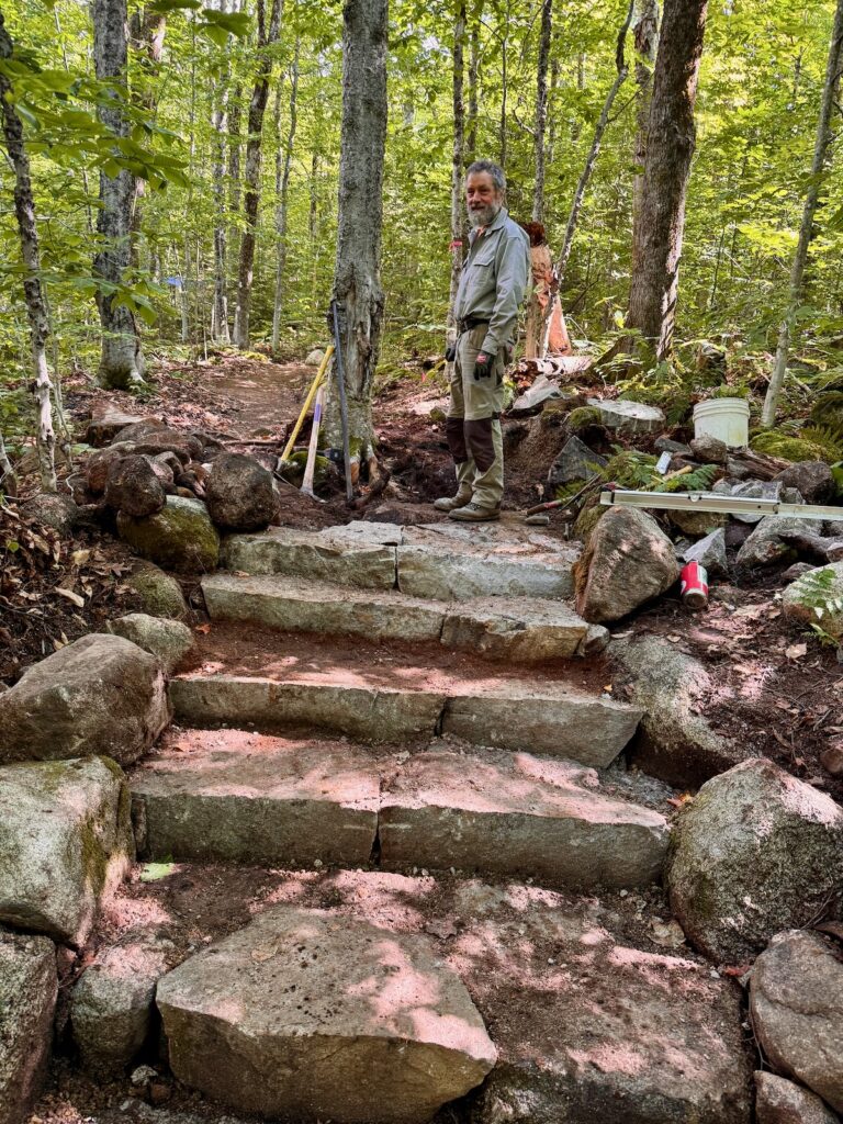
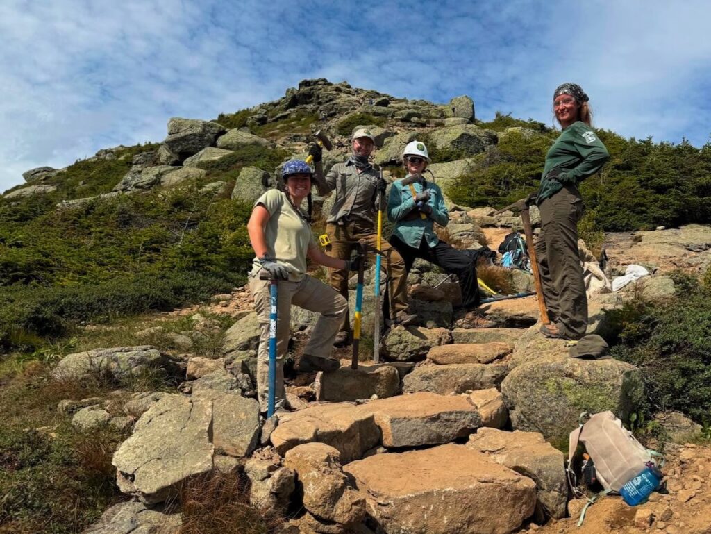
Sunday afternoon, standing at the base of our finished set of seven steps, a feeling of satisfaction overcame my body. For a solid minute, we stood there smiling, admiring what we had built and the hours of sourcing stones, crushing rock, and maneuvering boulders in a Tetris-like manner that went into this project. I felt proud. I felt like we had just accomplished something so large, and I began to think about how this trail feature we had just created would hopefully last the next 100 years or more, allowing for the trail to become revegetated in previously trampled areas. However, for me, this project was a lot more than just the final product. I have never worked on a trail crew before, and my first project being with an all female crew was incredibly inspiring. Not only were we crushing rocks with sledgehammers and moving 400-pound boulders with rock bars, but we made it home to our tent platform each evening with enough energy to cook a yummy dinner, play Scrabble, and laugh the night away, well, at least until we all usually started to crash around 9 pm.
Trail work, specifically intense rock work like this, can often be dominated by men, and working with a group of capable, strong, powerful women made this project even more meaningful.
Another realization I had throughout the weekend was how gratifying it feels when people see and appreciate your work. The majority of the work that went into the final result is not visible to hikers: the thought that goes into the design, choosing where to build the steps, hiking the heavy rock bars and pick mattocks up to the ridge, carefully measuring and picking which rocks to use where. For all the people who dismiss our attempts to keep them on trail, brushing us off, saying they already read the signs, there are so many people out there who really do care and notice our work. This is incredibly satisfying. Princess Diva Turtle, Hoot, and Rooster are all thru-hikers we met this weekend who took the time to stop and thank us for what we do. “You guys are amazing, keep up the incredible work!” Hikers taking the time to stop and chat for a bit, asking questions about what we are doing because they genuinely are curious, means so much to me. Being able to talk to people, educating them about the importance of staying on trail, why where they step matters, and how the work we are doing will hopefully make it easier for future hikers to stay on trail, makes all the hard, laborious hours worth it. Not just the physical work, but forming the connections with hikers, getting to teach them something they may not have known before, is one of my favorite parts of the job.
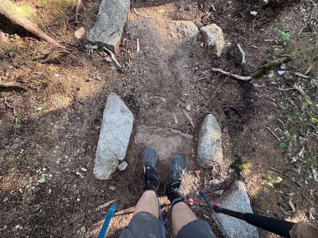
It was a weird feeling arriving on Friday, the landscape looking one way, and leaving Sunday having completely altered not only the physical tread of the trail but also how the hikers move through the terrain. In a way, we did a lot more than construct a new path. Because of these seven new steps, in ten to fifteen years hopefully the entire parallel social trail will be beginning to become revegetated. In thirty more years, hopefully we’ll be able to see a sea of green, abundant with Diapensia, Bog Bilberry, and Mountain Cranberry. However, while we were able to look back and admire our “finished” project, a clear set of steps that will guide people up the path away from the social trail, the bigger project is just beginning.
Projects like these are increasingly important as the ridge continues to see more visitors each year. While altering the physical trail is important and does have a large impact, there reaches a point where there are just too many people, and no matter how much we try to containthem, it is just an unmanageable number. 1400 people crossed the ridge this past Saturday. Being up there, seeing the lines of people, each following the person in front all the way up to Lincoln’s summit, it became overwhelming. The ridge, at least during a nice Saturday in summer, is no longer a place of solace to be alone with the ravens. During the rush, it is hard to fully be present, aware of the sound of the winds and all your surroundings. The sheer number of people has and will continue to affect not only the ecology of the ridge, but the shared experience of hikers in this environment. While we physically altered the tread, hopefully changing where people hike and eventually the vegetation on that trail section, seven steps is not enough. Seven steps are the continuation of a long, complex, and ongoing process of restoring the ridge.
In Ecuador, a biological corridor is formally understood as a geographically defined area that maintains or restores ecological connectivity between natural ecosystems, protected areas, and other zones of conservation value. Corridors support the movement of species, genetic exchange, and key ecological processes, while also integrating human land uses such as agriculture, community territories, and sustainable livelihoods. Rather than functioning as strictly protected areas, biological corridors in Ecuador emphasize landscape-scale planning, coordination among multiple actors, and management approaches that balance conservation with social and economic realities.
A Key Biodiversity Area (KBA) is a site recognized globally for its exceptional importance to the persistence of biodiversity. KBAs identify places that support threatened species, unique ecosystems, or critical ecological processes, using standardized scientific criteria. They do not create new protected areas on their own, but they help governments, communities, and conservation organizations prioritize where careful management, investment, and stewardship matter most.